Toggle navigation
LMEC Home
Exhibitions
Georeferencing
Tools for Teachers
Collections
My Favorites
Sign Up / Log In
Search
Search the map portal
Map Collection
Map Collection
Map Sets
Search
Search
Search for
Search In
All Fields
Creator
Title
Subject
Place
Search All Digital Collections
Advanced Search
8752 Results
My Search
Start Over
More Like
commonwealth:cj82kn67t
Remove constraint More Like: commonwealth:cj82kn67t
Filter your Search
Place
North and Central America
5,983
United States
4,900
Massachusetts
2,085
Europe
1,396
Suffolk (county)
1,048
Boston
1,021
Canada
460
Asia
438
more
Place
»
Topic
Boston (Mass.)--Maps
588
United States--Maps
282
Real property--Massachusetts--Boston--Maps
175
Massachusetts--Maps
166
Landowners--Massachusetts--Boston--Maps
133
New England--Maps
127
North America--Maps--Early works to 1800
103
New York (State)--Maps
85
more
Topic
»
Date
Date range begin
–
Date range end
Current results range from
1482
to
2023
View distribution
Creator
United States. Hydrographic Office
595
O.H. Bailey & Co
148
Des Barres, Joseph F. W. (Joseph Frederick Wallet), 1722-1824
123
United States. Post Office Dept
120
Ptolemy, 2nd cent
100
Walling, Henry Francis, 1825-1888
94
Geological Survey (U.S.)
86
Jefferys, Thomas, -1771
86
more
Creator
»
Format
Maps/Atlases
8,692
Manuscripts
217
Prints
56
Books
36
Objects/Artifacts
10
Drawings/Illustrations
8
Posters
5
Georeferenced
Yes
872
No
7,880
Collection
Norman B. Leventhal Map & Education Center Collection
8,698
Boston and New England Maps
2,238
Urban Maps
2,023
Maritime Charts and Atlases
1,083
American Revolutionary War-Era Maps
665
Boston Redevelopment Authority Collection
87
William L. Clements Library Collection
26
Maps from AAS
14
more
Collection
»
Available to use
No known restrictions
8,557
Creative Commons license
50
Search Constraints
Sort by relevance
relevance
title
date (asc)
date (desc)
Number of results to display per page
20 per page
10
per page
20
per page
50
per page
100
per page
View results as:
grid view
map view
Search Results
2321.
Electric railway map of eastern New England
2322.
Electric transmission systems of the United States, showing all transmission lines and interconnections above 11,000 volts also...
2323.
An elevation, plan, and history, of the Royal Exchange of London
2324.
Elihu Geer Sons new map of East Hartford, Connecticut
2325.
Elihu Geer sons' new map of the city of Hartford, Connecticut
2326.
Elihu Geer's sons' new map of Hartford from the latest surveys
2327.
Elihu Geer's sons' new map of Hartford from the latest surveys
2328.
Elizabeth Islands : Vineyard Sound the property of James Temple-Bowdoin Esq. : 1836
2329.
The embankment and park on Charles River Bay
2330.
The empire of Germany : divided into its general and perticuler parts & most humbly inscrib'd to ye most noble Lord Christopher...
2331.
The empire of Germany with the 13 cantons of Switzerland from the best authorities
2332.
Encampment of First Brigade, Maine Volunteer Militia, Augusta, Aug.25, 26, 27, 28, 1885
2333.
Endermo Harbor, Island of Jesso
2334.
England
2335.
England and Wales
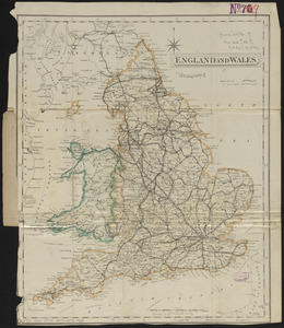
2336.
England and Wales accurately delineated from the latest surveys
2337.
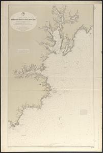
England--south coast, approaches to Falmouth : republished from the British Admiralty chart of 1872
2338.
England--south coast, Portland Harbor : republished from British Admy. chart no. 2268
2339.
The English Empire in America, Newfound-land, Canada, Hudsons Bay &c. in plano
2340.
The English empire in America, Newfound-land, Canada, Hudsons Bay, &c. in plano
‹ Prev
Next ›
1
2
…
113
114
115
116
117
118
119
120
121
…
437
438