Toggle navigation
LMEC Home
Exhibitions
Georeferencing
Tools for Teachers
Collections
My Favorites
Sign Up / Log In
Search
Search the map portal
Map Collection
Map Collection
Map Sets
Search
Search
Search for
Search In
All Fields
Creator
Title
Subject
Place
Search All Digital Collections
Advanced Search
8882 Results
My Search
Start Over
More Like
commonwealth:cc08kx48x
Remove constraint More Like: commonwealth:cc08kx48x
Filter your Search
Place
North and Central America
6,113
United States
5,029
Massachusetts
2,130
Europe
1,396
Suffolk (county)
1,228
Boston
1,201
Canada
449
Asia
438
more
Place
»
Topic
Boston (Mass.)--Maps
752
United States--Maps
282
Real property--Massachusetts--Boston--Maps
195
City planning--Massachusetts--Boston--Maps
176
Massachusetts--Maps
166
Landowners--Massachusetts--Boston--Maps
142
New England--Maps
104
North America--Maps--Early works to 1800
103
more
Topic
»
Date
Date range begin
–
Date range end
Current results range from
1482
to
2023
View distribution
Creator
United States. Hydrographic Office
595
Boston Redevelopment Authority
178
O.H. Bailey & Co
148
Des Barres, Joseph F. W. (Joseph Frederick Wallet), 1722-1824
124
United States. Post Office Dept
120
Ptolemy, 2nd cent
100
Walling, Henry Francis, 1825-1888
94
Geological Survey (U.S.)
87
more
Creator
»
Format
Maps/Atlases
8,822
Manuscripts
215
Prints
56
Books
36
Objects/Artifacts
10
Drawings/Illustrations
8
Posters
5
Georeferenced
Yes
885
No
7,997
Collection
Norman B. Leventhal Map & Education Center Collection
8,725
Boston and New England Maps
2,379
Urban Maps
2,161
Maritime Charts and Atlases
1,083
American Revolutionary War-Era Maps
638
Boston Redevelopment Authority Collection
210
Mapping Boston Collection
20
Massachusetts Real Estate Atlases
12
more
Collection
»
Available to use
No known restrictions
8,685
Creative Commons license
70
Search Constraints
Sort by relevance
relevance
title
date (asc)
date (desc)
Number of results to display per page
20 per page
10
per page
20
per page
50
per page
100
per page
View results as:
grid view
map view
Search Results
6021.
Official plan of the siege of Yorktown, Va. conducted by the Army of the Potomac under command of Maj. Gen. George B....
6022.
The official plat "City of Miami," Florida
6023.
Official tourist map of Imperial County, California
6024.
Off-street parking inventory for the Boston regional core
6025.
Off-street parking inventory within Boston proper
6026.
Ohio and N.W. Territory
6027.
Ohio boundary no. 1 South Bend of Lake Michigan : map, exhibiting the position occupied in the determination of the latitude of...
6028.
Ohio boundary no. 1 South Bend of Lake Michigan : map, exhibiting the position occupied in the determination of the latitude of...
6029.
Ohio boundary no. 2 : map exhibiting the positions occupied on the Maumee Bay and river: viz: Turtle Island, the North Cape,...
6030.
Oil and gas fields of Pennsylvania
6031.
Oil and gas fields of the state of California
6032.
Oil and gas fields of the state of Illinois
6033.
Oil and gas fields of the state of Kansas
6034.
Oil and gas fields of the state of Kentucky
6035.
Oil and gas fields of the state of Louisiana
6036.
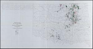
Oil and gas fields of the state of Oklahoma
6037.
Oil and gas fields of the state of Texas
6038.
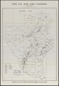
The oil and gas journal, August 29, 1935
6039.
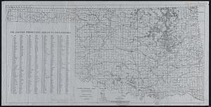
Oil and gas producing areas in Oklahoma
6040.
Oil City oil field, Fresno Co., California
‹ Prev
Next ›
1
2
…
298
299
300
301
302
303
304
305
306
…
444
445