Toggle navigation
LMEC Home
Exhibitions
Georeferencing
Tools for Teachers
Collections
My Favorites
Sign Up / Log In
Search
Search the map portal
Map Collection
Map Collection
Map Sets
Search
Search
Search for
Search In
All Fields
Creator
Title
Subject
Place
Search All Digital Collections
Advanced Search
8861 Results
My Search
Start Over
More Like
commonwealth:9s161c49q
Remove constraint More Like: commonwealth:9s161c49q
Filter your Search
Place
North and Central America
6,092
United States
5,008
Massachusetts
2,127
Europe
1,396
Suffolk (county)
1,207
Boston
1,180
Canada
449
Asia
438
more
Place
»
Topic
Boston (Mass.)--Maps
752
United States--Maps
282
Real property--Massachusetts--Boston--Maps
195
Massachusetts--Maps
166
City planning--Massachusetts--Boston--Maps
157
Landowners--Massachusetts--Boston--Maps
142
New England--Maps
104
North America--Maps--Early works to 1800
103
more
Topic
»
Date
Date range begin
–
Date range end
Current results range from
1482
to
2023
View distribution
Creator
United States. Hydrographic Office
595
Boston Redevelopment Authority
162
O.H. Bailey & Co
148
Des Barres, Joseph F. W. (Joseph Frederick Wallet), 1722-1824
124
United States. Post Office Dept
120
Ptolemy, 2nd cent
100
Walling, Henry Francis, 1825-1888
94
Geological Survey (U.S.)
87
more
Creator
»
Format
Maps/Atlases
8,801
Manuscripts
215
Prints
56
Books
36
Objects/Artifacts
10
Drawings/Illustrations
8
Posters
5
Georeferenced
Yes
885
No
7,976
Collection
Norman B. Leventhal Map & Education Center Collection
8,723
Boston and New England Maps
2,357
Urban Maps
2,141
Maritime Charts and Atlases
1,083
American Revolutionary War-Era Maps
638
Boston Redevelopment Authority Collection
191
Mapping Boston Collection
20
Massachusetts Real Estate Atlases
12
more
Collection
»
Available to use
No known restrictions
8,664
Creative Commons license
70
Search Constraints
Sort by relevance
relevance
title
date (asc)
date (desc)
Number of results to display per page
20 per page
10
per page
20
per page
50
per page
100
per page
View results as:
grid view
map view
Search Results
8481.
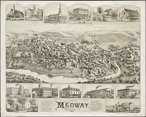
View of Medway, Massachusetts : 1887
8482.
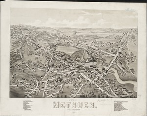
View of Methuen, Massachusetts : 1882
8483.
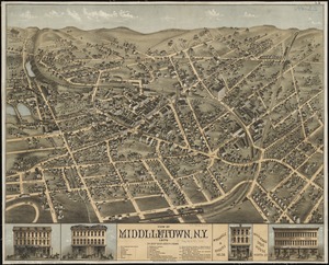
View of Middletown, N.Y : 1874
8484.
View of Milford, Conn : 1882
8485.
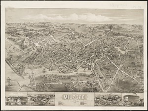
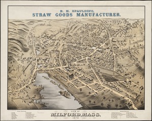
View of Milford, Mass : 1876
8486.
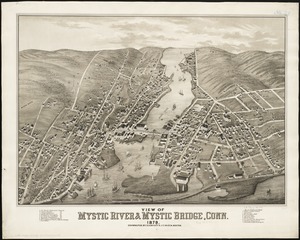
View of Mystic River & Mystic Bridge, Conn. 1879
8487.
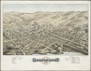
View of Natick, Mass : 1877, population about 8000
8488.
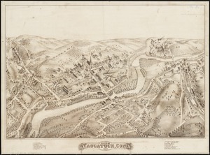
View of Naugatuck, Conn : 1877
8489.
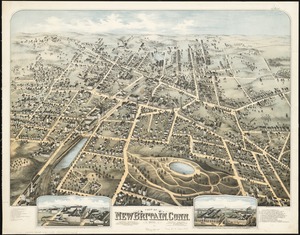
View of New Britain, Conn : 1875
8490.
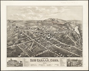
View of New Canaan, Conn : 1878
8491.
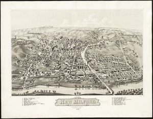
View of New Milford, Conn : 1882
8492.
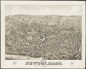
View of Newton, Mass : comprising Wards 1 & 7 & environs of the city of Newton
8493.
View of North Easton, Massachusetts, 1881
8494.
View of North Manchester, Connecticut : 1880
8495.
View of Northborough, Massachusetts : 1887
8496.
View of Oneida, N.Y : 1874
8497.
View of Palmer, Mass
8498.
A view of part of the town of Boston in New-England and Brittish [sic] ships of war landing their troops! 1768
8499.
View of Peabody, Mass : 1877
8500.
A view of Port Hood, sailing into the harbor : A view of the Plaister Cliffs, in George's Bay
‹ Prev
Next ›
1
2
…
421
422
423
424
425
426
427
428
429
…
443
444


![A view of part of the town of Boston in New-England and Brittish [sic] ships of war landing their troops! 1768](https://bpldcassets.blob.core.windows.net/derivatives/images/commonwealth:4m90f851p/image_thumbnail_300.jpg)

