Toggle navigation
LMEC Home
Exhibitions
Georeferencing
Tools for Teachers
Collections
My Favorites
Sign Up / Log In
Search
Search the map portal
Map Collection
Map Collection
Map Sets
Search
Search
Search for
Search In
All Fields
Creator
Title
Subject
Place
Search All Digital Collections
Advanced Search
8944 Results
My Search
Start Over
More Like
commonwealth:9s1619901
Remove constraint More Like: commonwealth:9s1619901
Filter your Search
Place
North and Central America
6,175
United States
5,091
Massachusetts
2,168
Europe
1,396
Suffolk (county)
1,282
Boston
1,255
Canada
449
Asia
438
more
Place
»
Topic
Boston (Mass.)--Maps
752
United States--Maps
282
City planning--Massachusetts--Boston--Maps
221
Real property--Massachusetts--Boston--Maps
207
Massachusetts--Maps
166
Landowners--Massachusetts--Boston--Maps
146
Urban renewal--Massachusetts--Boston--Maps
138
New England--Maps
104
more
Topic
»
Date
Date range begin
–
Date range end
Current results range from
1482
to
2023
View distribution
Creator
United States. Hydrographic Office
595
Boston Redevelopment Authority
224
O.H. Bailey & Co
148
Des Barres, Joseph F. W. (Joseph Frederick Wallet), 1722-1824
124
United States. Post Office Dept
120
Ptolemy, 2nd cent
100
Walling, Henry Francis, 1825-1888
94
Geological Survey (U.S.)
87
more
Creator
»
Format
Maps/Atlases
8,883
Manuscripts
215
Prints
56
Books
36
Objects/Artifacts
10
Drawings/Illustrations
9
Posters
5
Georeferenced
Yes
885
No
8,059
Collection
Norman B. Leventhal Map & Education Center Collection
8,727
Boston and New England Maps
2,427
Urban Maps
2,209
Maritime Charts and Atlases
1,083
American Revolutionary War-Era Maps
642
Boston Redevelopment Authority Collection
257
Massachusetts Real Estate Atlases
22
Mapping Boston Collection
21
more
Collection
»
Available to use
No known restrictions
8,733
Creative Commons license
71
Search Constraints
Sort by relevance
relevance
title
date (asc)
date (desc)
Number of results to display per page
20 per page
10
per page
20
per page
50
per page
100
per page
View results as:
grid view
map view
Search Results
6521.
A plan of Boston in 1722
6522.
A plan of Boston in New England with its environs : including Milton, Dorchester, Roxbury, Brooklin, Cambridge, Medford,...
6523.
Plan of Boston Land Co's land in Boston & Revere
6524.
[Plan of Boston neck]
6525.
Plan of Boston showing existing ways and owners on December 25, 1630
6526.
Plan of Boston showing existing ways and owners on December 25, 1635
6527.
Plan of Boston showing existing ways and owners on December 25, 1635
6528.
Plan of Boston showing existing ways and owners on December 25, 1635
6529.
Plan of Boston showing existing ways and owners on December 25, 1640
6530.
Plan of Boston showing existing ways and owners on December 25, 1645
6531.
Plan of boundary line between the Commonwealth of Massachusetts and the State of Connecticut : as located defined and marked by...
6532.
Plan of Bradford Estate, Roslindale, Ward 23, Boston
6533.
Plan of Briggs Place, in Newton
6534.
Plan of Brighton : reduced from the Ordnance Survey
6535.
Plan of building lots on Columbus Avenue, and various streets and squares west of said avenue : to be sold by public auction at...
6536.
Plan of building lots on the "Kimball" Estate Arlington, Mass. ... at 3 o'clock p.m
6537.
Plan of Charles River : from the Waltham line to Boston harbor
6538.
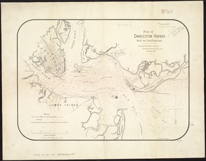
Plan of Charleston Harbor, and its fortifications
6539.
Plan of Chestnut Hill, in Brookline & Newton : August 1856
6540.
Plan of city lands and streets s.w. of Dover St : prepared from new surveys
‹ Prev
Next ›
1
2
…
323
324
325
326
327
328
329
330
331
…
447
448


![[Plan of Boston neck]](https://bpldcassets.blob.core.windows.net/derivatives/images/commonwealth:9s161g52n/image_thumbnail_300.jpg)