Toggle navigation
LMEC Home
Exhibitions
Georeferencing
Tools for Teachers
Collections
My Favorites
Sign Up / Log In
Search
Search the map portal
Map Collection
Map Collection
Map Sets
Search
Search
Search for
Search In
All Fields
Creator
Title
Subject
Place
Search All Digital Collections
Advanced Search
8167 Results
My Search
Start Over
More Like
commonwealth:9g54xx38h
Remove constraint More Like: commonwealth:9g54xx38h
Filter your Search
Place
North and Central America
4,916
United States
3,747
Suffolk (county)
1,029
Boston
1,000
Europe
963
Canada
427
France
269
Massachusetts
259
more
Place
»
Topic
Boston (Mass.)--Maps
575
United States--Maps
270
Real property--Massachusetts--Boston--Maps
175
Massachusetts--Maps
161
Landowners--Massachusetts--Boston--Maps
133
North America--Maps--Early works to 1800
103
New England--Maps
99
Europe--Maps
78
more
Topic
»
Date
Date range begin
–
Date range end
Current results range from
1482
to
2023
View distribution
Creator
United States. Hydrographic Office
357
O.H. Bailey & Co
148
Des Barres, Joseph F. W. (Joseph Frederick Wallet), 1722-1824
123
United States. Post Office Dept
120
Ptolemy, 2nd cent
100
Walling, Henry Francis, 1825-1888
94
Jefferys, Thomas, -1771
84
Geological Survey (U.S.)
83
more
Creator
»
Format
Maps/Atlases
8,108
Manuscripts
215
Prints
51
Books
36
Objects/Artifacts
10
Drawings/Illustrations
8
Posters
4
Georeferenced
Yes
869
No
7,298
Collection
Norman B. Leventhal Map Center Collection
8,163
Boston and New England Maps
2,184
Urban Maps
1,925
Maritime Charts and Atlases
750
American Revolutionary War-Era Maps
616
Boston Redevelopment Authority Collection
86
Massachusetts Real Estate Atlases
4
Available to use
No known restrictions
8,022
Creative Commons license
46
Search Constraints
Sort by relevance
relevance
title
date (asc)
date (desc)
Number of results to display per page
20 per page
10
per page
20
per page
50
per page
100
per page
View results as:
grid view
map view
Search Results
1.
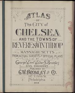
Atlas of the city of Chelsea and the towns of Revere & Winthrop, Massachusetts : from actual surveys and official plans
2.
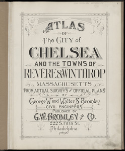
Atlas of the city of Chelsea and the towns of Revere & Winthrop, Massachusetts : from actual surveys and official plans
3.
Atlas of the city of Chelsea and the towns of Revere and Winthrop : from actual surveys and official plans
4.
Atlas of the county of Suffolk, Massachusetts : vol. 4th including East Boston, city of Chelsea, Revere and Winthrop : from...
5.
Atlas of the city of Chelsea and the towns of Revere & Winthrop, Massachusetts
6.
Atlas of the city of Chelsea and the towns of Revere and Winthrop, Massachusetts
7.
Atlas of the county of Suffolk, Massachusetts, vol. 4 : including East Boston, city of Chelsea, Revere and Winthrop
8.
A block of 6 brick houses the property of Isaac Stebbins Esquire
9.
Plan of land in Chelsea belonging to the heirs of Joshua Carter
10.
Plan of the hotel estate in Chelsea belonging to the Winnisimmet Company
11.
Plan of the Hotel Estate in Chelsea belonging to the Winnisimmet Company
12.
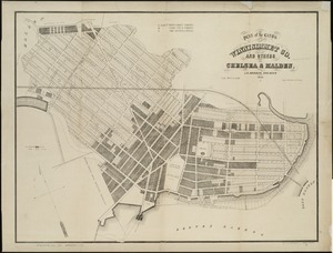
Plan of the lands of the Winnisimmet Co. and others in Chelsea & Malden
13.
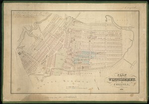
Plan of Winnisimmet, in Chelsea
14.
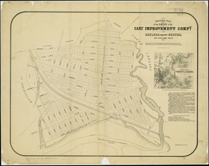
Proposed plan of the estate of the Cary Improvement Compy : in Chelsea opposite Boston, and in the same county
15.
City of Chelsea with the location of its churches, schools and principal industries
16.
Map of Chelsea, Everett, Revere, & Winthrop
17.
Map of the cities of Boston, Cambridge, Somerville and Chelsea, and the town of Brookline with parts of Newton, Malden and...
18.
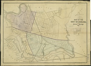
Map of the city of Chelsea : from actual surveys 1867
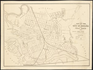
19.
Map of the city of Chelsea from actual surveys : 1884
20.
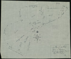
A plan of the Pitts Farm in Chelsea
‹ Prev
Next ›
1
2
3
4
5
…
408
409