Toggle navigation
LMEC Home
Exhibitions
Georeferencing
Tools for Teachers
Collections
My Favorites
Sign Up / Log In
Search
Search the map portal
Map Collection
Map Collection
Map Sets
Search
Search
Search for
Search In
All Fields
Creator
Title
Subject
Place
Search All Digital Collections
Advanced Search
61 Results
My Search
Start Over
More Like
commonwealth:8c97pq34j
Remove constraint More Like: commonwealth:8c97pq34j
Filter your Search
Place
North and Central America
45
Canada
38
New France
25
Saint Lawrence River
13
Huron, Lake
10
United States
9
Quebec
8
Québec
8
more
Place
»
Topic
New France--Maps
25
Seven Years' War, 1756-1763--Campaigns--Canada--Maps
21
Saint Lawrence River--Maps
14
Huron, Lake (Mich. and Ont.)--Maps
11
Canada--Maps--Early works to 1800
8
Fortification--Québec (Province)
8
Québec (Québec)--Maps
7
Seigneuries--Québec (Province)--Maps
6
more
Topic
»
Date
Date range begin
–
Date range end
Current results range from
1752
to
1893
View distribution
Creator
Bellin, Jacques Nicolas, 1703-1772
8
Mackellar, Patrick, 1717-1778
7
Holland, Samuel, 1728-1801
6
U.S. Lake Survey
6
Dougal, William H., 1822-1895
5
Montrésor, John, 1736-1799
4
United States. Topographical Bureau
4
Collins, John, -1795
3
more
Creator
»
Format
Maps/Atlases
61
Georeferenced
No
61
Collection
American Revolutionary War-Era Maps
52
Library and Archives Canada Collection
52
Norman B. Leventhal Map & Education Center Collection
9
Maritime Charts and Atlases
6
Available to use
No known restrictions
9
Search Constraints
Sort by relevance
relevance
title
date (asc)
date (desc)
Number of results to display per page
20 per page
10
per page
20
per page
50
per page
100
per page
View results as:
grid view
map view
Search Results
61.
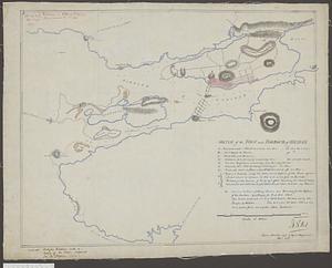
Sketch of the town and harbour of Halifax
‹ Prev
Next ›
1
2
3
4