Toggle navigation
LMEC Home
Exhibitions
Georeferencing
Tools for Teachers
Collections
My Favorites
Sign Up / Log In
Search
Search the map portal
Map Collection
Map Collection
Map Sets
Search
Search
Search for
Search In
All Fields
Creator
Title
Subject
Place
Search All Digital Collections
Advanced Search
8702 Results
My Search
Start Over
More Like
commonwealth:7h14b4926
Remove constraint More Like: commonwealth:7h14b4926
Filter your Search
Place
North and Central America
5,933
United States
4,848
Massachusetts
2,078
Europe
1,396
Suffolk (county)
1,045
Boston
1,018
Canada
449
Asia
438
more
Place
»
Topic
Boston (Mass.)--Maps
586
United States--Maps
284
Real property--Massachusetts--Boston--Maps
175
Massachusetts--Maps
162
Landowners--Massachusetts--Boston--Maps
133
North America--Maps--Early works to 1800
103
New England--Maps
102
Europe--Maps
79
more
Topic
»
Date
Date range begin
–
Date range end
Current results range from
1482
to
2023
View distribution
Creator
United States. Hydrographic Office
595
O.H. Bailey & Co
148
Des Barres, Joseph F. W. (Joseph Frederick Wallet), 1722-1824
123
United States. Post Office Dept
119
Ptolemy, 2nd cent
100
Walling, Henry Francis, 1825-1888
94
Geological Survey (U.S.)
86
Jefferys, Thomas, -1771
85
more
Creator
»
Format
Maps/Atlases
8,642
Manuscripts
215
Prints
56
Books
36
Objects/Artifacts
10
Drawings/Illustrations
8
Posters
5
Georeferenced
Yes
869
No
7,833
Collection
Norman B. Leventhal Map & Education Center Collection
8,693
Boston and New England Maps
2,232
Urban Maps
2,023
Maritime Charts and Atlases
1,083
American Revolutionary War-Era Maps
624
Boston Redevelopment Authority Collection
87
William L. Clements Library Collection
5
American Antiquarian Society Collection
3
more
Collection
»
Available to use
No known restrictions
8,551
Creative Commons license
47
Search Constraints
Sort by relevance
relevance
title
date (asc)
date (desc)
Number of results to display per page
20 per page
10
per page
20
per page
50
per page
100
per page
View results as:
grid view
map view
Search Results
1.
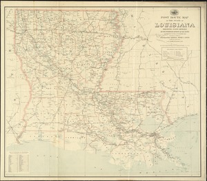
Post route map of the state of Louisiana showing post offices and the intermediate distances on mail routes in operation on the...
2.
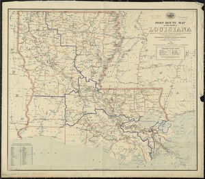
Post route map of the State of Louisiana showing post offices with the intermediate distances and mail routes in operation on...
3.
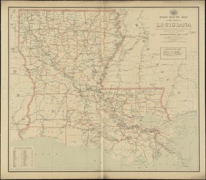
Post route map of the state of Louisiana showing post offices with the intermediate distances on mail routes in operation on...
4.
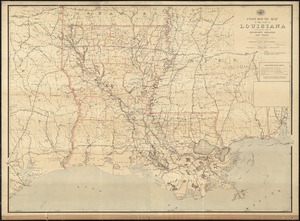
Post route map of the State of Louisiana with adjacent parts of Mississippi, Arkansas, and Texas showing post offices with the...
5.
From Vicksburg to New Orleans
6.
Baton Rouge
7.
Breton Sound
8.
Gallup's map of Louisiana
9.
Louisiana : Chef Menteur sheet
10.
Louisiana : Hahnville sheet
11.
Louisiana : Saint Bernard sheet
12.
Louisiana : New Orleans sheet
13.
Louisiana : Spanish Fort sheet
14.
Louisiana : Bonnet Carre sheet
15.
Louisiana
16.
Louisiana, a dream state
17.
Manuscript maps of U.S. states
18.
Map of a part of Louisiana and Mississippi, illustrating the operations of the U.S. Forces in the Department of the Gulf
19.
Map of Louisiana, Mississippi and Alabama : constructed from the latest authorities
20.
Map of the state of Louisiana
‹ Prev
Next ›
1
2
3
4
5
…
435
436