Toggle navigation
LMEC Home
Exhibitions
Georeferencing
Tools for Teachers
Collections
My Favorites
Sign Up / Log In
Search
Search the map portal
Map Collection
Map Collection
Map Sets
Search
Search
Search for
Search In
All Fields
Creator
Title
Subject
Place
Search All Digital Collections
Advanced Search
8706 Results
My Search
Start Over
More Like
commonwealth:7h14b1392
Remove constraint More Like: commonwealth:7h14b1392
Filter your Search
Place
North and Central America
5,931
United States
4,846
Massachusetts
2,079
Europe
1,396
Suffolk (county)
1,046
Boston
1,019
Canada
449
Asia
438
more
Place
»
Topic
Boston (Mass.)--Maps
586
United States--Maps
282
Real property--Massachusetts--Boston--Maps
175
Massachusetts--Maps
162
Landowners--Massachusetts--Boston--Maps
133
North America--Maps--Early works to 1800
108
New England--Maps
102
Europe--Maps
79
more
Topic
»
Date
Date range begin
–
Date range end
Current results range from
1482
to
2023
View distribution
Creator
United States. Hydrographic Office
595
O.H. Bailey & Co
148
Des Barres, Joseph F. W. (Joseph Frederick Wallet), 1722-1824
123
United States. Post Office Dept
120
Ptolemy, 2nd cent
100
Walling, Henry Francis, 1825-1888
94
Jefferys, Thomas, -1771
87
Geological Survey (U.S.)
86
more
Creator
»
Format
Maps/Atlases
8,646
Manuscripts
218
Prints
56
Books
36
Objects/Artifacts
10
Drawings/Illustrations
8
Posters
5
Georeferenced
Yes
870
No
7,836
Collection
Norman B. Leventhal Map & Education Center Collection
8,694
Boston and New England Maps
2,233
Urban Maps
2,023
Maritime Charts and Atlases
1,083
American Revolutionary War-Era Maps
627
Boston Redevelopment Authority Collection
87
Richard H. Brown Revolutionary War Map Collection at Mount Vernon
4
MacLean Collection Map Library
3
more
Collection
»
Available to use
No known restrictions
8,552
Creative Commons license
53
Search Constraints
Sort by relevance
relevance
title
date (asc)
date (desc)
Number of results to display per page
20 per page
10
per page
20
per page
50
per page
100
per page
View results as:
grid view
map view
Search Results
741.
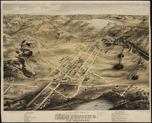
Bird's eye view of Ishpeming, L.S. Michigan : 1871
742.
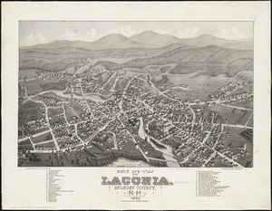
Bird's eye view of Laconia, Belknap County, N.H : 1883
743.
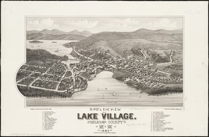
Bird's eye view of Lake Village, Belknap County, N.H : 1883
744.
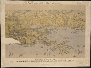
Birds eye view of Louisiana, Mississippi, Alabama and part of Florida
745.
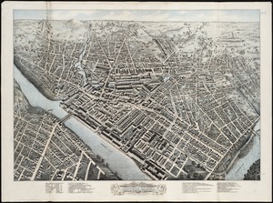
Birds eye view of Lowell, Mass : 1876
746.
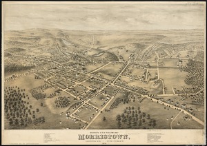
Bird's eye view of Morristown, Morris Co., New Jersey : 1876
747.
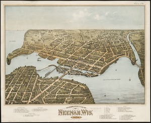
Bird's eye view of Neenah, Wis : 1879
748.
Birds eye view of North and South Carolina and part of Georgia
749.
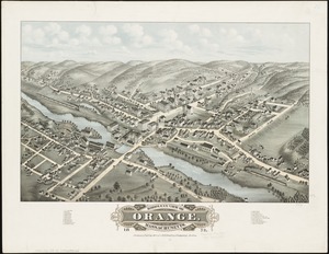
Bird's eye view of Orange, Massachusetts : 1878
750.
Bird's eye view of part of Maryland, Distr of Columbia and part of Virginia
751.
Bird's eye view of Pawtucket & Central Falls, R.I. 1877
752.
Bird's eye view of Philadelphia
753.
Bird's eye view of Pittsfield, Mass : 1876
754.
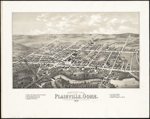
Bird's eye view of Plainville, Conn : 1878
755.
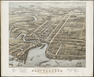
Bird's eye view of Plattsburgh, Clinton Co., New York 1877
756.
Bird's eye view of Port Townsend, Puget Sound, Washington Territory : from the north-east, 1878
757.
Bird's eye view of Portsmouth, Rockingham Co., New Hampshire
758.
Bird's eye view of Rochester, Strafford County, New Hampshire, 1877 : from a position, east of town
759.
Birds eye view of Syracuse, New York : 1874
760.
Bird's eye view of the city of Brockton, Plymouth County, Mass : looking southwest, 1882
‹ Prev
Next ›
1
2
…
34
35
36
37
38
39
40
41
42
…
435
436