Toggle navigation
LMEC Home
Exhibitions
Georeferencing
Tools for Teachers
Collections
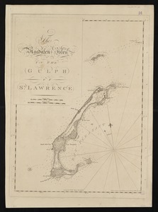
My Favorites
Sign Up / Log In
Search
Search the map portal
Map Collection
Map Collection
Map Sets
Search
Search
Search for
Search In
All Fields
Creator
Title
Subject
Place
Search All Digital Collections
Advanced Search
8167 Results
My Search
Start Over
More Like
commonwealth:7h149v38k
Remove constraint More Like: commonwealth:7h149v38k
Filter your Search
Place
North and Central America
4,916
United States
3,602
Suffolk (county)
1,026
Boston
999
Europe
963
Canada
429
France
269
Massachusetts
249
more
Place
»
Topic
Boston (Mass.)--Maps
574
United States--Maps
270
Real property--Massachusetts--Boston--Maps
174
Massachusetts--Maps
160
Landowners--Massachusetts--Boston--Maps
132
North America--Maps--Early works to 1800
103
New England--Maps
99
Europe--Maps
78
more
Topic
»
Date
Date range begin
–
Date range end
Current results range from
1482
to
2023
View distribution
Creator
United States. Hydrographic Office
357
O.H. Bailey & Co
148
Des Barres, Joseph F. W. (Joseph Frederick Wallet), 1722-1824
122
United States. Post Office Dept
120
Ptolemy, 2nd cent
100
Walling, Henry Francis, 1825-1888
94
Jefferys, Thomas, -1771
85
Geological Survey (U.S.)
82
more
Creator
»
Format
Maps/Atlases
8,108
Manuscripts
217
Prints
51
Books
36
Objects/Artifacts
10
Drawings/Illustrations
8
Posters
4
Georeferenced
Yes
869
No
7,298
Collection
Norman B. Leventhal Map Center Collection
8,163
Boston and New England Maps
2,184
Urban Maps
1,925
Maritime Charts and Atlases
750
American Revolutionary War-Era Maps
619
Boston Redevelopment Authority Collection
86
Newberry Library Collection
2
Richard H. Brown Revolutionary War Map Collection at Mount Vernon
2
Available to use
No known restrictions
8,022
Creative Commons license
48
Search Constraints
Sort by relevance
relevance
title
date (asc)
date (desc)
Number of results to display per page
10 per page
10
per page
20
per page
50
per page
100
per page
View results as:
grid view
map view
Search Results
1.
[Chart of the coast of Quebec from the Riviere St. Jean to Grand Hermine Bay]
2.
Bay of Chaleurs
3.
Chart of the Streights of Belle Isle
4.
Harbour and bay of Gaspee : Maul Bay
5.
The harbours of Rishibucto & Buctush : on the west shore of the Gulph of St. Lawrence
6.
The Magdalen Isles in the Gulph of St. Lawrence
7.
Miramichi Bay
8.
[Bay of Seven Islands]
9.
An exact chart of the river St. Laurence, from Fort Frontenac to the island of Anticosti shewing the soundings, rocks, shoals...
10.
A plan of Quebec and environs, with its defences and the occasional entrenched camps of the French commanded by Marquis de...
‹ Prev
Next ›
1
2
3
4
5
…
816
817
![[Chart of the coast of Quebec from the Riviere St. Jean to Grand Hermine Bay]](https://bpldcassets.blob.core.windows.net/derivatives/images/commonwealth:7h149v50v/image_thumbnail_300.jpg)


![[Bay of Seven Islands]](https://bpldcassets.blob.core.windows.net/derivatives/images/commonwealth:7h149v48t/image_thumbnail_300.jpg)

