Toggle navigation
LMEC Home
Exhibitions
Georeferencing
Tools for Teachers
Collections
My Favorites
Sign Up / Log In
Search
Search the map portal
Map Collection
Map Collection
Map Sets
Search
Search
Search for
Search In
All Fields
Creator
Title
Subject
Place
Search All Digital Collections
Advanced Search
8652 Results
My Search
Start Over
More Like
commonwealth:6h446v240
Remove constraint More Like: commonwealth:6h446v240
Filter your Search
Place
North and Central America
5,946
United States
4,870
Massachusetts
2,068
Europe
1,359
Suffolk (county)
1,124
Boston
1,097
Canada
448
Asia
422
more
Place
»
Topic
Boston (Mass.)--Maps
600
United States--Maps
278
Real property--Massachusetts--Boston--Maps
254
Landowners--Massachusetts--Boston--Maps
170
Massachusetts--Maps
160
City planning--Massachusetts--Boston--Maps
112
North America--Maps--Early works to 1800
103
New England--Maps
101
more
Topic
»
Date
Date range begin
–
Date range end
Current results range from
1482
to
2023
View distribution
Creator
United States. Hydrographic Office
594
O.H. Bailey & Co
148
Des Barres, Joseph F. W. (Joseph Frederick Wallet), 1722-1824
123
United States. Post Office Dept
120
Boston Redevelopment Authority
113
Ptolemy, 2nd cent
100
Walling, Henry Francis, 1825-1888
94
Geological Survey (U.S.)
86
more
Creator
»
Format
Maps/Atlases
8,593
Manuscripts
215
Prints
56
Books
36
Objects/Artifacts
10
Drawings/Illustrations
8
Posters
4
Georeferenced
Yes
869
No
7,783
Collection
Norman B. Leventhal Map & Education Center Collection
8,568
Boston and New England Maps
2,261
Urban Maps
1,990
Maritime Charts and Atlases
1,081
American Revolutionary War-Era Maps
616
Boston Redevelopment Authority Collection
136
Massachusetts Real Estate Atlases
35
Applied Geographics, Inc. Records
2
Available to use
No known restrictions
8,476
Creative Commons license
46
Search Constraints
Sort by relevance
relevance
title
date (asc)
date (desc)
Number of results to display per page
20 per page
10
per page
20
per page
50
per page
100
per page
View results as:
grid view
map view
Search Results
1781.
City of Boston plan of Columbia Road, showing connection with Franklin Park and Marine Park : under chapter 394 acts of 1897
1782.
City of Boston topographic and planimetric survey : [Downtown and North End]
1783.
City of Boston zoning map
1784.
City of Brockton
1785.
City of Butte : indexed map showing Butte and vicinity with location of mines, schools, public buildings, streets, etc
1786.
City of Cambridge, Mass : 1877
1787.
City of Chelsea with the location of its churches, schools and principal industries
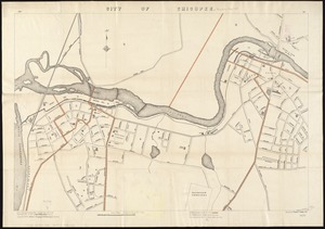
1788.
City of Chicopee
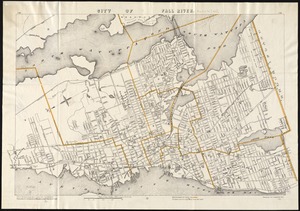
1789.
City of Fall River
1790.
City of Fall River, Mass : 1877
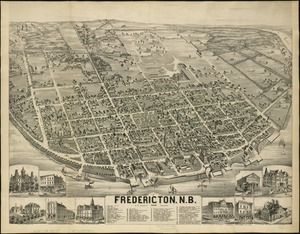
1791.
City of Fredericton, N.B
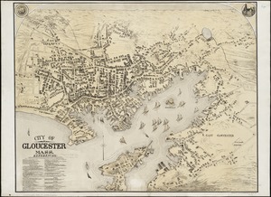
1792.
City of Gloucester, Mass
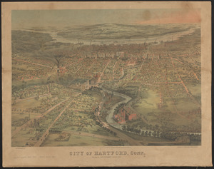
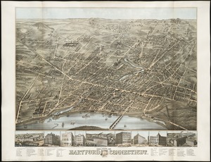
1793.
City of Hartford, Conn.
1794.
The city of Hartford Connecticut : 1877
1795.
City of Haverhill, Massachusetts
1796.
The city of Hoboken : New Jersey, 1881
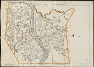
1797.
City of Lawrence
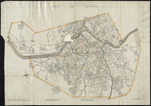
1798.
City of Lowell
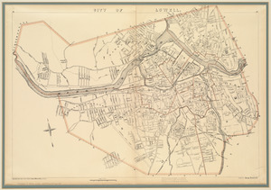
1799.
City of Lowell
1800.
City of Lynn, Mass
‹ Prev
Next ›
1
2
…
86
87
88
89
90
91
92
93
94
…
432
433