Toggle navigation
LMEC Home
Exhibitions
Georeferencing
Tools for Teachers
Collections
My Favorites
Sign Up / Log In
Search
Search the map portal
Map Collection
Map Collection
Map Sets
Search
Search
Search for
Search In
All Fields
Creator
Title
Subject
Place
Search All Digital Collections
Advanced Search
194 Results
My Search
Start Over
More Like
commonwealth:63961k367
Remove constraint More Like: commonwealth:63961k367
Filter your Search
Place
North and Central America
183
United States
180
Massachusetts
153
Middlesex (county)
66
Cambridge
49
Suffolk (county)
18
Boston
17
Bristol (county)
9
more
Place
»
Topic
Cambridge (Mass.)--Maps
52
Real property--Massachusetts--Cambridge--Maps
21
Massachusetts--Maps
19
Landowners--Massachusetts--Cambridge--Maps
13
Boston (Mass.)--Maps
10
Charlestown (Boston, Mass.)--Maps
6
Roxbury (Boston, Mass.)--Maps
6
Buildings--Massachusetts--Brookline--Maps
5
more
Topic
»
Date
Date range begin
–
Date range end
Current results range from
1831
to
2010
View distribution
Creator
Applied Geographics, Inc.
60
MassGIS (Office : Mass.)
56
Massachusetts. Executive Office of Environmental Affairs
32
Geological Survey (U.S.)
9
Massachusetts Bays Program
8
Massachusetts Coastal Zone Management Office
8
G.W. Bromley & Co.
7
Bromley, George Washington
6
more
Creator
»
Format
Maps/Atlases
193
Ephemera
1
Manuscripts
1
Georeferenced
Yes
12
No
182
Collection
Norman B. Leventhal Map & Education Center Collection
188
Boston and New England Maps
155
Applied Geographics, Inc. Records
143
Urban Maps
65
Maritime Charts and Atlases
17
Massachusetts Real Estate Atlases
6
Available to use
No known restrictions
187
Creative Commons license
1
Search Constraints
Sort by relevance
relevance
title
date (asc)
date (desc)
Number of results to display per page
20 per page
10
per page
20
per page
50
per page
100
per page
View results as:
grid view
map view
Search Results
1.
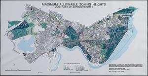
Maximum allowable zoning heights : contrast of zoning heights
2.
Atlas of Middlesex County. Vol. 1. Cambridge, Somerville, Arlington, Belmont, Watertown, Everett, Malden, Medford, Newton,...
3.
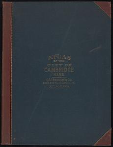
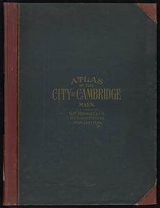
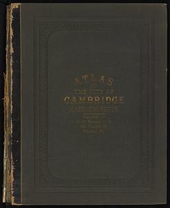
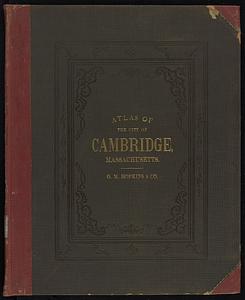
Atlas of the city of Cambridge, Massachusetts
4.
Atlas of the city of Cambridge, Massachusetts
5.
Atlas of the city of Cambridge, Massachusetts
6.
Atlas of the city of Cambridge, Massachusetts
7.
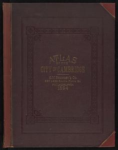
Atlas of the city of Cambridge, Massachusetts : from actual surveys and official plans
8.
Atlas of the city of Cambridge, Massachusetts : from actual surveys and official plans
9.
Atlas of the city of Cambridge, Massachusetts : from actual surveys and official plans
10.
Atlas of the city of Cambridge, Massachusetts : from official records, private plan and actual surveys
11.
Atlas of the city of Cambridge, Massachusetts : from actual surveys and official plans
12.
Atlas of the city of Cambridge, Middlesex Co., Massachusetts
13.
Atlas of the city of Cambridge, Middlesex Co., Massachusetts
14.
Broad Canal, Cambridge : condition of retaining walls and bed of Canal, inspection for Committee on Charles River Dam, Oct. 30,...
15.
Compiled plan, showing Millers Creek and a portion of Charles River
16.
Insurance map of Charlestown : portions of Roxbury (now annexed to Boston) and Cambridge : 1868 : corrected Nov. 1871
17.
Insurance map of Charlestown : portions of Roxbury (now annexed to Boston) and Cambridge
18.
Insurance maps of Boston volume 4 : comprising portions of Charlestown, East Cambridge, Cambridge Port, Old Cambridge & Somerville
19.
Lechmere Canal, Cambridge : condition of retaining walls and bed of canal, inspection for Committee on Charles River Dam, Nov....
20.
Map of Cambridge
‹ Prev
Next ›
1
2
3
4
5
…
9
10