Toggle navigation
LMEC Home
Exhibitions
Georeferencing
Tools for Teachers
Collections
My Favorites
Sign Up / Log In
Search
Search the map portal
Map Collection
Map Collection
Map Sets
Search
Search
Search for
Search In
All Fields
Creator
Title
Subject
Place
Search All Digital Collections
Advanced Search
1046 Results
My Search
Start Over
More Like
commonwealth:5m60t8722
Remove constraint More Like: commonwealth:5m60t8722
Filter your Search
Place
North and Central America
1,042
United States
1,037
Suffolk (county)
1,022
Boston
1,021
Massachusetts
718
Roxbury
53
South End
45
Downtown Boston
40
more
Place
»
Topic
Boston (Mass.)--Maps
752
City planning--Massachusetts--Boston--Maps
366
Urban renewal--Massachusetts--Boston--Maps
234
Real property--Massachusetts--Boston--Maps
131
Land use--Massachusetts--Boston--Maps
99
Buildings--Massachusetts--Boston--Maps
86
Landowners--Massachusetts--Boston--Maps
76
Local transit--Massachusetts--Boston--Maps
57
more
Topic
»
Date
Date range begin
–
Date range end
Current results range from
1743
to
2023
View distribution
Creator
Boston Redevelopment Authority
355
Geo. H. Walker & Co
27
Boynton, George W., d. 1884
21
Sampson, Davenport & Co
21
Sampson, Murdock & Co
20
Bromley, George Washington
18
Bromley, Walter Scott
17
Lufkin, Richard F. (Richard Friend)
17
more
Creator
»
Format
Maps/Atlases
1,046
Manuscripts
9
Prints
1
Georeferenced
Yes
98
No
948
Collection
Boston and New England Maps
866
Urban Maps
768
Norman B. Leventhal Map & Education Center Collection
624
Boston Redevelopment Authority Collection
403
American Revolutionary War-Era Maps
25
Mapping Boston Collection
20
Massachusetts Real Estate Atlases
12
William L. Clements Library Collection
10
more
Collection
»
Available to use
No known restrictions
978
Creative Commons license
34
Search Constraints
Sort by relevance
relevance
title
date (asc)
date (desc)
Number of results to display per page
20 per page
10
per page
20
per page
50
per page
100
per page
View results as:
grid view
map view
Search Results
561.
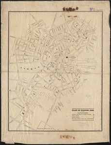
Plan of Boston 1828
562.
A Plan of Boston, and its environs. : Shewing the true situation of His Majesty's army. And also those of the rebels
563.
Plan of Boston and its vicinity
564.
Plan of Boston and its vicinity
565.
Plan of Boston and its vicinity
566.
Plan of Boston and its vicinity showing the connection of the Grand Junction Rail Road with the Harbor and other Rail-roads
567.
Plan of Boston and its vicinity, showing the drainage area of Stony Brook which empties into the full basin of the Back Bay
568.
Plan of Boston and its vicinity, showing the drainage area of Stony Brook which empties into the full basin of the Back Bay
569.
Plan of Boston and Roxbury
570.
Plan of Boston comprising a part of Charlestown and Cambridge
571.
Plan of Boston comprising a part of Charlestown and Cambridge
572.
Plan of Boston comprising a part of Charlestown and Cambridge
573.
Plan of Boston comprising a part of Charlestown and Cambridge
574.
Plan of Boston comprising a part of Charlestown and Cambridge
575.
Plan of Boston comprising a part of Charlestown and Cambridge
576.
Plan of Boston comprising a part of Charlestown and Cambridge
577.
Plan of Boston comprising a part of Charlestown and Cambridge
578.
A plan of Boston, from actual survey
579.
A plan of Boston, from actual survey by Osgood Carleton
580.
A plan of Boston in New England with its environs, including Milton, Dorchester, Roxbury, Brooklin, Cambridge, Medford,...
‹ Prev
Next ›
1
2
…
25
26
27
28
29
30
31
32
33
…
52
53