Toggle navigation
LMEC Home
Exhibitions
Georeferencing
Tools for Teachers
Collections
My Favorites
Sign Up / Log In
Search
Search the map portal
Map Collection
Map Collection
Map Sets
Search
Search
Search for
Search In
All Fields
Creator
Title
Subject
Place
Search All Digital Collections
Advanced Search
8717 Results
My Search
Start Over
More Like
commonwealth:4m90ff228
Remove constraint More Like: commonwealth:4m90ff228
Filter your Search
Place
North and Central America
5,948
United States
4,861
Massachusetts
2,079
Europe
1,396
Suffolk (county)
1,046
Boston
1,019
Canada
470
Asia
438
more
Place
»
Topic
Boston (Mass.)--Maps
586
United States--Maps
294
Real property--Massachusetts--Boston--Maps
175
Massachusetts--Maps
162
Landowners--Massachusetts--Boston--Maps
133
New England--Maps
107
North America--Maps--Early works to 1800
104
Europe--Maps
79
more
Topic
»
Date
Date range begin
–
Date range end
Current results range from
1482
to
2023
View distribution
Creator
United States. Hydrographic Office
595
O.H. Bailey & Co
148
Des Barres, Joseph F. W. (Joseph Frederick Wallet), 1722-1824
123
United States. Post Office Dept
120
Ptolemy, 2nd cent
100
Walling, Henry Francis, 1825-1888
94
Geological Survey (U.S.)
86
Jefferys, Thomas, -1771
85
more
Creator
»
Format
Maps/Atlases
8,657
Manuscripts
215
Prints
56
Books
36
Objects/Artifacts
10
Drawings/Illustrations
8
Posters
5
Georeferenced
Yes
869
No
7,848
Collection
Norman B. Leventhal Map & Education Center Collection
8,695
Boston and New England Maps
2,233
Urban Maps
2,023
Maritime Charts and Atlases
1,083
American Revolutionary War-Era Maps
638
Boston Redevelopment Authority Collection
87
American Antiquarian Society Collection
14
William L. Clements Library Collection
8
more
Collection
»
Available to use
No known restrictions
8,552
Creative Commons license
48
Search Constraints
Sort by relevance
relevance
title
date (asc)
date (desc)
Number of results to display per page
20 per page
10
per page
20
per page
50
per page
100
per page
View results as:
grid view
map view
Search Results
221.
America the wonderland : a pictorial map of the United States
222.
America, with the European Settlements, and the conquests of Cortes and Pizarro
223.
America with those known parts in that unknowne worlde both people and manner of buildings
224.
America with those known parts in that unknowne worlde both people and manner of buildings
225.
Americae
226.
Americae
227.
Americae mappa generalis : secundum legitimas projectionis stereographicae regulas relationesque recentissimas et observationes...
228.
Americae nova descriptio
229.
Americae nova discriptio
230.
Americae nova tabula
231.
Americae nova tabula
232.
Americae pars meridionalis
233.
Americae pars meridionalis
234.
Americae pars meridionalis
235.
Americæ pars, nunc Virginia dicta, primum ab Anglis inuenta, sumtibus Dn. Walteri Raleigh, equestris ordinis Viri, Anno Dn̄i....
236.
Americae siue noui orbis, noua descriptio
237.
Americae sive Indiae Occidentalis : tabula generalis
238.
Americae tam septentrionalis quam meridionalis in mappa geographica delineatio
239.
American explorations in the West, 1803-1852
240.
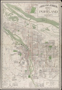
American Map and Reproducing Company's map of Portland and vicinity
‹ Prev
Next ›
1
2
…
8
9
10
11
12
13
14
15
16
…
435
436