Toggle navigation
LMEC Home
Exhibitions
Georeferencing
Tools for Teachers
Collections
My Favorites
Sign Up / Log In
Search
Search the map portal
Map Collection
Map Collection
Map Sets
Search
Search
Search for
Search In
All Fields
Creator
Title
Subject
Place
Search All Digital Collections
Advanced Search
8943 Results
My Search
Start Over
More Like
commonwealth:3f463917s
Remove constraint More Like: commonwealth:3f463917s
Filter your Search
Place
North and Central America
6,174
United States
5,078
Massachusetts
2,206
Europe
1,396
Suffolk (county)
1,207
Boston
1,180
Canada
450
Asia
438
more
Place
»
Topic
Boston (Mass.)--Maps
752
United States--Maps
282
Massachusetts--Maps
235
Real property--Massachusetts--Boston--Maps
195
City planning--Massachusetts--Boston--Maps
157
Landowners--Massachusetts--Boston--Maps
142
New England--Maps
106
North America--Maps--Early works to 1800
103
more
Topic
»
Date
Date range begin
–
Date range end
Current results range from
1482
to
2023
View distribution
Creator
United States. Hydrographic Office
595
Boston Redevelopment Authority
162
O.H. Bailey & Co
148
Des Barres, Joseph F. W. (Joseph Frederick Wallet), 1722-1824
124
United States. Post Office Dept
120
Ptolemy, 2nd cent
100
Walling, Henry Francis, 1825-1888
95
Geological Survey (U.S.)
92
more
Creator
»
Format
Maps/Atlases
8,882
Manuscripts
219
Prints
56
Books
36
Objects/Artifacts
10
Drawings/Illustrations
8
Posters
5
Ephemera
1
Georeferenced
Yes
894
No
8,049
Collection
Norman B. Leventhal Map & Education Center Collection
8,765
Boston and New England Maps
2,404
Urban Maps
2,144
Maritime Charts and Atlases
1,083
American Revolutionary War-Era Maps
659
Boston Redevelopment Authority Collection
194
Applied Geographics, Inc. Records
22
Mapping Boston Collection
22
more
Collection
»
Available to use
No known restrictions
8,707
Creative Commons license
73
Search Constraints
Sort by relevance
relevance
title
date (asc)
date (desc)
Number of results to display per page
20 per page
10
per page
20
per page
50
per page
100
per page
View results as:
grid view
map view
Search Results
1601.
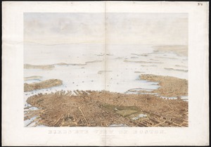
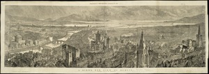
Bird's eye view of Boston
1602.
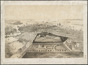
Bird's eye view of Boston
1603.
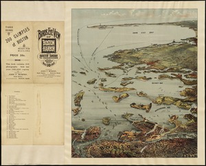
Bird's eye view of Boston Harbor and south shore to Provincetown showing steamboat routes
1604.
Bird's eye view of Bristol, R.I : 1877
1605.
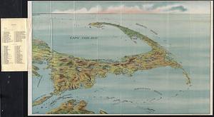
Bird's eye view of Cape Cod
1606.
Bird's eye view of Carbondale, Pa
1607.
Bird's eye view of Carlinville, Macoupin County Ill : 1873
1608.
Birds eye view of Casco Bay, Portland, Maine, and surroundings
1609.
Bird's eye view of Clinton, Mass : 1876
1610.
Bird's eye view of Collingwood, Ontario, Canada
1611.
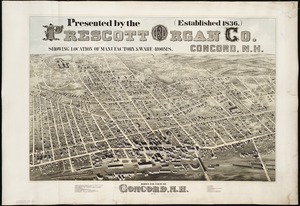
Bird's eye view of Concord, N.H : 1875
1612.
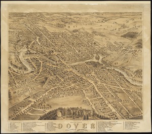
Bird's eye view of Dover, Strafford Co., New Hampshire : 1877, looking southwest
1613.
A Bird's eye view of Dublin
1614.
Bird's eye view of Eastport, Washington Co., Maine
1615.
Bird's eye view of Fitchburg, Mass : 1875
1616.
Birds eye view of Florida and part of Georgia and Alabama
1617.
Bird's eye view of Fort Edward, New York : 1875
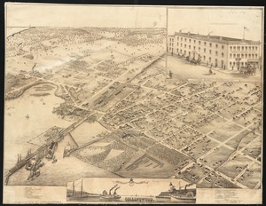
1618.
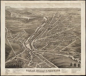
Bird's eye view of Great Falls, Strafford Co., New Hampshire & Berwick, York Co., Maine, 1877 : from position north west,...
1619.
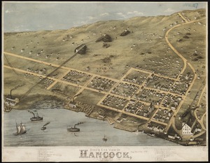
Bird's eye view of Hancock, L.S. Mich, 1873 : looking north west
1620.
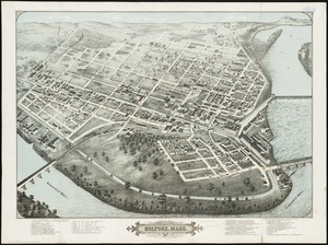
Bird's eye view of Holyoke, Mass : 1877
‹ Prev
Next ›
1
2
…
77
78
79
80
81
82
83
84
85
…
447
448