Search Constraints
Search Results


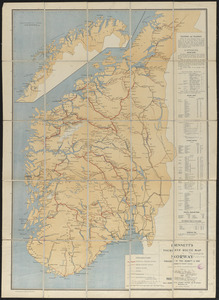
1562. La Beauce


1564. Becket

1565. Becket, Mass


1567. Bedford Co., Pa

1568. Bedford irrigation farm


1574. Belgii veteris typus


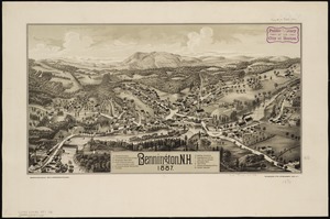
1576. Bellows Falls, Vt
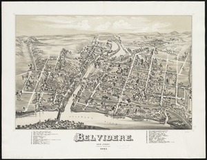
1577. Belvidere : New Jersey