Toggle navigation
LMEC Home
Exhibitions
Georeferencing
Tools for Teachers
Collections
My Favorites
Sign Up / Log In
Search
Search the map portal
Map Collection
Map Collection
Map Sets
Search
Search
Search for
Search In
All Fields
Creator
Title
Subject
Place
Search All Digital Collections
Advanced Search
202 Results
My Search
Start Over
More Like
commonwealth:3f4632294
Remove constraint More Like: commonwealth:3f4632294
Filter your Search
Place
North and Central America
179
United States
169
Massachusetts
128
Boston Harbor
86
Boston
66
Suffolk (county)
66
New England
31
World
19
more
Place
»
Topic
Boston Harbor (Mass.)--Maps
67
Boston (Mass.)--Maps
40
New England--Maps--Early works to 1800
23
World maps--Early works to 1800
19
Harbors--Massachusetts--Boston--Maps
17
Boston (Mass.)--History--Revolution, 1775-1783--Maps--Early works to 1800
16
Nautical charts--Massachusetts--Boston Harbor
14
Boston Harbor (Mass.)--Maps--Early works to 1800
13
more
Topic
»
Date
Date range begin
–
Date range end
Current results range from
1493
to
1985
View distribution
Creator
United States Coast Survey
9
Page, Thomas Hyde, Sir, 1746-1821
7
Bache, A. D. (Alexander Dallas), 1806-1867
6
Des Barres, Joseph F. W. (Joseph Frederick Wallet), 1722-1824
6
Southack, Cyprian, 1662-1745
5
Bellin, Jacques Nicolas, 1703-1772
4
Board of Harbor and Land Commissioners of Massachusetts
4
Massachusetts. Board of Harbor Commissioners
4
more
Creator
»
Format
Maps/Atlases
201
Posters
1
Prints
1
Georeferenced
Yes
34
No
168
Collection
Norman B. Leventhal Map & Education Center Collection
189
Mapping Boston Collection
142
Boston and New England Maps
117
American Revolutionary War-Era Maps
47
Maritime Charts and Atlases
34
Urban Maps
29
William L. Clements Library Collection
10
Boston Redevelopment Authority Collection
2
more
Collection
»
Available to use
Creative Commons license
137
No known restrictions
54
Search Constraints
Sort by relevance
relevance
title
date (asc)
date (desc)
Number of results to display per page
20 per page
10
per page
20
per page
50
per page
100
per page
View results as:
grid view
map view
Search Results
61.
A plan of the town and chart of the harbour of Boston exhibiting a view of the islands castle forts and entrances into the said...
62.
A plan of the town and harbour of Boston and the country adjacent with the road from Boston to Concord shewing the place of the...
63.
Plan showing encroachments upon the inner basins of Boston Harbor : accompanying annual report of Harbor and Land...
64.
Plano de la bahia y puerto de Boston
65.
Port facilities at Boston, MA
66.
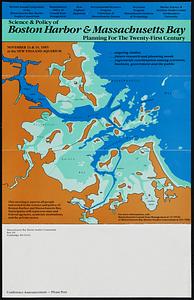
Science & policy of Boston Harbor symposium poster
67.
Sections of soundings made by order of the Harbor Committee of 1852
68.
Sketch of Boston Harbor and Bay
69.
Sketch of the narrows in Boston Harbor
70.
Thirty-miles round Boston
71.
The town & harbour of Boston &c.
72.
The able doctor; or America swallowing the bitter draught
73.
An accurate map of North America : describing and distinguishing the British and Spanish dominions on this great continent :...
74.
An accurate map of North America : describing and distinguishing the British and Spanish dominions on this great continent :...
75.
An accurate map of the four New England states : shewing in a distinct manner all the mountains, forts, rivers, swamps,...
76.
An actual survey of the sea coast from New York to the I. Cape Brition : with tables of the direct and thwart courses &...
77.
Americae siue noui orbis, noua descriptio
78.
Americae siue noui orbis, noua descriptio
79.
Baye et port de Boston
80.
Belgii Novi, Angliae Novae, et partis Virginiae : novissima delineatio
‹ Prev
Next ›
1
2
3
4
5
6
7
8
…
10
11