Toggle navigation
LMEC Home
Exhibitions
Georeferencing
Tools for Teachers
Collections
My Favorites
Sign Up / Log In
Search
Search the map portal
Map Collection
Map Collection
Map Sets
Search
Search
Search for
Search In
All Fields
Creator
Title
Subject
Place
Search All Digital Collections
Advanced Search
102 Results
My Search
Start Over
More Like
commonwealth:2r370940p
Remove constraint More Like: commonwealth:2r370940p
Filter your Search
Place
North and Central America
87
United States
86
Massachusetts
54
Virginia
13
Boston
9
Suffolk (county)
9
Connecticut
5
Essex (county)
5
more
Place
»
Topic
Massachusetts--Maps
19
United States--History--Civil War, 1861-1865--Maps
10
Land use--Massachusetts--Maps
7
Virginia--History--Civil War, 1861-1865--Maps
7
Connecticut--Maps
6
Watersheds--Massachusetts--Maps
5
Boston Metropolitan Area (Mass.)--Maps
4
New England--Maps
4
more
Topic
»
Date
Date range begin
–
Date range end
Current results range from
1867
to
2015
View distribution
Creator
MassGIS (Office : Mass.)
20
Massachusetts. Executive Office of Environmental Affairs
16
Michler, N. (Nathaniel), 1827-1881
15
New York Lithographing, Engraving and Printing Co.
12
Strasser, J.
12
Theilkuhl, F.
12
Weyss, J. E.
12
Geological Survey (U.S.)
10
more
Creator
»
Format
Maps/Atlases
99
Ephemera
2
Documents
1
Posters
1
Georeferenced
Yes
1
No
101
Collection
Norman B. Leventhal Map & Education Center Collection
101
David Judkins Weaver Papers
98
Boston and New England Maps
65
Urban Maps
8
Applied Geographics, Inc. Records
1
Massachusetts Real Estate Atlases
1
Available to use
No known restrictions
101
Search Constraints
Sort by relevance
relevance
title
date (asc)
date (desc)
Number of results to display per page
20 per page
10
per page
20
per page
50
per page
100
per page
View results as:
grid view
map view
Search Results
101.
The Wilderness
102.
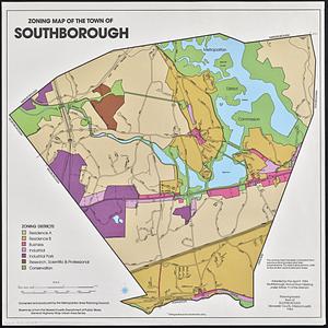
Zoning map of the town of Southborough
‹ Prev
Next ›
1
2
3
4
5
6