Toggle navigation
LMEC Home
Exhibitions
Georeferencing
Tools for Teachers
Collections
My Favorites
Sign Up / Log In
Search
Search the map portal
Map Collection
Map Collection
Map Sets
Search
Search
Search for
Search In
All Fields
Creator
Title
Subject
Place
Search All Digital Collections
Advanced Search
8727 Results
My Search
Start Over
More Like
commonwealth:2514p072r
Remove constraint More Like: commonwealth:2514p072r
Filter your Search
Place
North and Central America
5,926
United States
4,844
Massachusetts
2,079
Europe
1,397
Suffolk (county)
1,046
Boston
1,019
Canada
449
Asia
439
more
Place
»
Topic
Boston (Mass.)--Maps
586
United States--Maps
282
Real property--Massachusetts--Boston--Maps
175
Massachusetts--Maps
162
Landowners--Massachusetts--Boston--Maps
133
North America--Maps--Early works to 1800
103
New England--Maps
102
Europe--Maps
80
more
Topic
»
Date
Date range begin
–
Date range end
Current results range from
1482
to
2023
View distribution
Creator
United States. Hydrographic Office
595
O.H. Bailey & Co
148
Des Barres, Joseph F. W. (Joseph Frederick Wallet), 1722-1824
123
United States. Post Office Dept
120
Ptolemy, 2nd cent
100
Walling, Henry Francis, 1825-1888
94
Geological Survey (U.S.)
86
Jefferys, Thomas, -1771
85
more
Creator
»
Format
Maps/Atlases
8,667
Manuscripts
215
Prints
56
Books
36
Objects/Artifacts
10
Drawings/Illustrations
8
Posters
5
Georeferenced
Yes
869
No
7,858
Collection
Norman B. Leventhal Map & Education Center Collection
8,714
Boston and New England Maps
2,233
Urban Maps
2,023
Maritime Charts and Atlases
1,083
American Revolutionary War-Era Maps
616
Boston Redevelopment Authority Collection
87
Mapping Boston Collection
19
Sidney R. Knafel Map Collection at Phillips Academy
13
Available to use
No known restrictions
8,553
Creative Commons license
66
Search Constraints
Sort by relevance
relevance
title
date (asc)
date (desc)
Number of results to display per page
20 per page
10
per page
20
per page
50
per page
100
per page
View results as:
grid view
map view
Search Results
4641.
Map showing the relative distances of Porsmouth [i.e. Portsmouth] and Boston from Concord & Manchester, N.H
4642.
Map showing the routes of The Winthrop Steamboat Co
4643.
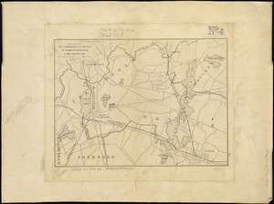
Map showing the seat of war in middle and east Tennessee
4644.
Map showing the sources of some of the offensive odors perceived in Boston, 1878
4645.
Map showing the telegraph lines in operation, under contract, and contemplated, to complete the circuit of the globe
4646.
Map showing the telegraph lines in operation, under contract, and contemplated, to complete the circuit of the globe
4647.
Map showing the temporary connection of Sudbury River with Lake Cochituate
4648.
Map showing the terminal facilities of Boston
4649.
Map showing the terminal facilities of Boston
4650.
Map showing the terminal facilities of Boston
4651.
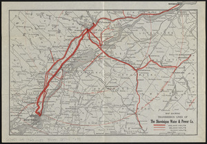
Map showing transmission lines of the Shawinigan Water & Power Co.
4652.
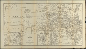
Map sixth division railway mail service
4653.
Map tenth division railway mail service
4654.
Map third division railway mail service
4655.
Map to accompany the report on the exploratory survey of the Canadian Pacific Railway
4656.
Map to illustrate an exploration of the country lying between the Missouri River and the Rocky Mountains, on the line of the...
4657.
Map to illustrate the battle of Bull Run, Stone Bridge or Manassas Plains
4658.
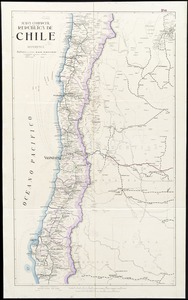
Mapa comercial de la República de Chile
4659.
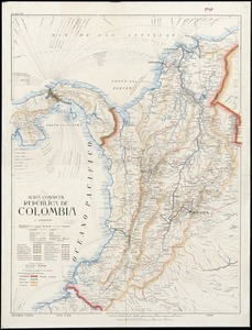
Mapa comercial de la República de Colombia
4660.
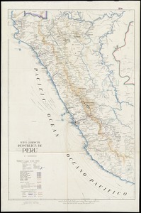
Mapa comercial de la república de Peru
‹ Prev
Next ›
1
2
…
229
230
231
232
233
234
235
236
237
…
436
437
![Map showing the relative distances of Porsmouth [i.e. Portsmouth] and Boston from Concord & Manchester, N.H](https://bpldcassets.blob.core.windows.net/derivatives/images/commonwealth:7h14b104z/image_thumbnail_300.jpg)