Toggle navigation
LMEC Home
Exhibitions
Georeferencing
Tools for Teachers
Collections
My Favorites
Sign Up / Log In
Search
Search the map portal
Map Collection
Map Collection
Map Sets
Search
Search
Search for
Search In
All Fields
Creator
Title
Subject
Place
Search All Digital Collections
Advanced Search
8943 Results
My Search
Start Over
More Like
commonwealth:1257bt078
Remove constraint More Like: commonwealth:1257bt078
Filter your Search
Place
North and Central America
6,174
United States
5,090
Massachusetts
2,146
Europe
1,396
Suffolk (county)
1,289
Boston
1,262
Canada
449
Asia
438
more
Place
»
Topic
Boston (Mass.)--Maps
753
United States--Maps
282
Real property--Massachusetts--Boston--Maps
254
City planning--Massachusetts--Boston--Maps
207
Landowners--Massachusetts--Boston--Maps
170
Massachusetts--Maps
166
Urban renewal--Massachusetts--Boston--Maps
114
New England--Maps
104
more
Topic
»
Date
Date range begin
–
Date range end
Current results range from
1482
to
2023
View distribution
Creator
United States. Hydrographic Office
595
Boston Redevelopment Authority
212
O.H. Bailey & Co
148
Des Barres, Joseph F. W. (Joseph Frederick Wallet), 1722-1824
124
United States. Post Office Dept
120
Ptolemy, 2nd cent
100
Walling, Henry Francis, 1825-1888
94
Geological Survey (U.S.)
87
more
Creator
»
Format
Maps/Atlases
8,883
Manuscripts
215
Prints
56
Books
36
Objects/Artifacts
10
Drawings/Illustrations
8
Posters
5
Georeferenced
Yes
885
No
8,058
Collection
Norman B. Leventhal Map & Education Center Collection
8,726
Boston and New England Maps
2,413
Urban Maps
2,196
Maritime Charts and Atlases
1,083
American Revolutionary War-Era Maps
638
Boston Redevelopment Authority Collection
244
Massachusetts Real Estate Atlases
38
Mapping Boston Collection
20
more
Collection
»
Available to use
No known restrictions
8,720
Creative Commons license
70
Search Constraints
Sort by relevance
relevance
title
date (asc)
date (desc)
Number of results to display per page
20 per page
10
per page
20
per page
50
per page
100
per page
View results as:
grid view
map view
Search Results
6541.
Plan of Boston Land Co's land in Boston & Revere
6542.
[Plan of Boston neck]
6543.
Plan of boundary line between the Commonwealth of Massachusetts and the State of Connecticut : as located defined and marked by...
6544.
Plan of Briggs Place, in Newton
6545.
Plan of Brighton : reduced from the Ordnance Survey
6546.
Plan of building lots and land in Cambridge & Somerville belonging to Mr. Ozias Morse
6547.
Plan of building lots on the "Kimball" Estate Arlington, Mass. ... at 3 o'clock p.m
6548.
Plan of Charles River : from the Waltham line to Boston harbor
6549.
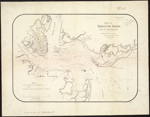
Plan of Charleston Harbor, and its fortifications
6550.
Plan of Charlestown
6551.
Plan of Charlestown
6552.
Plan of Charlestown peninsula in the state of Massachusetts
6553.
Plan of Chestnut Hill, in Brookline & Newton : August 1856
6554.
Plan of Clinton Company's property, "Sawyer's Mills" Boylston, Mass.
6555.
Plan of Coleman's Farm in Newington containing 13 acres - 125 rods
6556.
Plan of cottage lots on Littlejohn's Island, Casco Bay, about 7 1/2 miles northeast of Portland
6557.
Plan of Deer Island
6558.
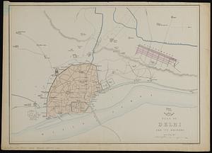
Plan of Delhi and its environs
6559.
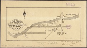
Plan of development, south end of Eagle Mine
6560.
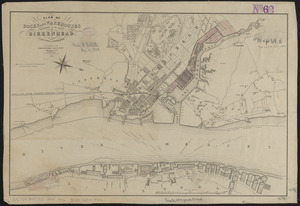
Plan of docks and warehouses proposed to be made at Birkenhead, in the County of Chester
‹ Prev
Next ›
1
2
…
324
325
326
327
328
329
330
331
332
…
447
448

![[Plan of Boston neck]](https://bpldcassets.blob.core.windows.net/derivatives/images/commonwealth:9s161g52n/image_thumbnail_300.jpg)