Toggle navigation
LMEC Home
Exhibitions
Georeferencing
Tools for Teachers
Collections
My Favorites
Sign Up / Log In
Search
Search the map portal
Map Collection
Map Collection
Map Sets
Search
Search
Search for
Search In
All Fields
Creator
Title
Subject
Place
Search All Digital Collections
Advanced Search
8172 Results
My Search
Start Over
More Like
commonwealth:1257bc094
Remove constraint More Like: commonwealth:1257bc094
Filter your Search
Place
North and Central America
4,921
United States
3,753
Suffolk (county)
1,031
Boston
1,004
Europe
963
Canada
427
Massachusetts
294
France
269
more
Place
»
Topic
Boston (Mass.)--Maps
574
United States--Maps
270
Real property--Massachusetts--Boston--Maps
179
Massachusetts--Maps
160
Landowners--Massachusetts--Boston--Maps
137
North America--Maps--Early works to 1800
103
New England--Maps
99
Europe--Maps
78
more
Topic
»
Date
Date range begin
–
Date range end
Current results range from
1482
to
2023
View distribution
Creator
United States. Hydrographic Office
357
O.H. Bailey & Co
148
Des Barres, Joseph F. W. (Joseph Frederick Wallet), 1722-1824
123
United States. Post Office Dept
120
Ptolemy, 2nd cent
100
Walling, Henry Francis, 1825-1888
94
Jefferys, Thomas, -1771
84
Geological Survey (U.S.)
82
more
Creator
»
Format
Maps/Atlases
8,113
Manuscripts
215
Prints
51
Books
36
Objects/Artifacts
10
Drawings/Illustrations
8
Posters
4
Georeferenced
Yes
869
No
7,303
Collection
Norman B. Leventhal Map Center Collection
8,162
Boston and New England Maps
2,185
Urban Maps
1,926
Maritime Charts and Atlases
750
American Revolutionary War-Era Maps
616
Boston Redevelopment Authority Collection
87
Massachusetts Real Estate Atlases
9
Available to use
No known restrictions
8,022
Creative Commons license
46
Search Constraints
Sort by relevance
relevance
title
date (asc)
date (desc)
Number of results to display per page
20 per page
10
per page
20
per page
50
per page
100
per page
View results as:
grid view
map view
Search Results
41.
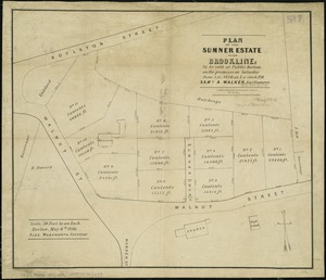
Plan of the Sumner Estate in Brookline : to be sold at public auction, on the premises on Saturday June 1st, 1850, at 3 o'clock...
42.
Preliminary plan for the extension of Commonwealth Avenue along Beacon Street Brookline : showing connection with Chestnut Hill...
43.
Preliminary plan for widening Beacon Street from the Back Bay district of Boston to the public pleasure ground at Chestnut Hill...
44.
Preliminary plan for widening Chestnut Hill Avenue
45.
The town of Brookline : 1896
46.
Town of Brookline, Mass. assessors' plans 1930
47.
Town of Brookline Mass. Assessors' plans 1943
48.
Town of Brookline, Mass. assessors' plans 1944
49.
Trees in Brookline, Massachusetts
50.
Atlas of Dorchester, West Roxbury, and Brighton, City of Boston
51.
Atlas of the city of Boston : volume 7, Brighton
52.
Atlas of the city of Boston : ward 25 Brighton
53.
Atlas of the city of Boston : wards 25 and 26, Brighton
54.
Atlas of the county of Suffolk, Massachusetts, vol. 7 : late town of Brighton, now ward 19 of Boston, Massachusetts
55.
North Harvard project area : location map
56.
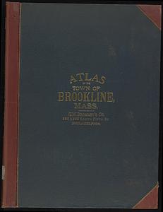
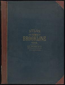
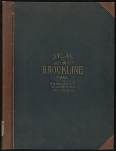
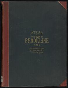
Atlas of the town of Brookline, Norfolk County, Massachusetts
57.
Atlas of the town of Brookline, Norfolk County, Massachusetts
58.
Atlas of the town of Brookline, Norfolk County, Massachusetts
59.
Atlas of the town of Brookline, Norfolk County, Massachusetts
60.
The 100th anniversary map of Abraham Lincoln's visit to Massachusetts, September 11-23, 1848
‹ Prev
Next ›
1
2
3
4
5
6
7
…
408
409