Toggle navigation
LMEC Home
Exhibitions
Georeferencing
Tools for Teachers
Collections
My Favorites
Sign Up / Log In
Search
Search the map portal
Map Collection
Map Collection
Map Sets
Search
Search
Search for
Search In
All Fields
Creator
Title
Subject
Place
Search All Digital Collections
Advanced Search
8873 Results
My Search
Start Over
More Like
commonwealth:1257b986t
Remove constraint More Like: commonwealth:1257b986t
Filter your Search
Place
North and Central America
6,104
United States
5,020
Massachusetts
2,139
Europe
1,396
Suffolk (county)
1,219
Boston
1,192
Canada
449
Asia
438
more
Place
»
Topic
Boston (Mass.)--Maps
752
United States--Maps
282
Real property--Massachusetts--Boston--Maps
195
City planning--Massachusetts--Boston--Maps
168
Massachusetts--Maps
166
Landowners--Massachusetts--Boston--Maps
142
New England--Maps
104
North America--Maps--Early works to 1800
103
more
Topic
»
Date
Date range begin
–
Date range end
Current results range from
1482
to
2023
View distribution
Creator
United States. Hydrographic Office
595
Boston Redevelopment Authority
171
O.H. Bailey & Co
148
Des Barres, Joseph F. W. (Joseph Frederick Wallet), 1722-1824
124
United States. Post Office Dept
120
Ptolemy, 2nd cent
100
Walling, Henry Francis, 1825-1888
94
Geological Survey (U.S.)
87
more
Creator
»
Format
Maps/Atlases
8,813
Manuscripts
215
Prints
56
Books
36
Objects/Artifacts
10
Drawings/Illustrations
8
Posters
5
Georeferenced
Yes
885
No
7,988
Collection
Norman B. Leventhal Map & Education Center Collection
8,723
Boston and New England Maps
2,370
Urban Maps
2,153
Maritime Charts and Atlases
1,083
American Revolutionary War-Era Maps
638
Boston Redevelopment Authority Collection
203
Mapping Boston Collection
20
Massachusetts Real Estate Atlases
12
more
Collection
»
Available to use
No known restrictions
8,676
Creative Commons license
70
Search Constraints
Sort by relevance
relevance
title
date (asc)
date (desc)
Number of results to display per page
20 per page
10
per page
20
per page
50
per page
100
per page
View results as:
grid view
map view
Search Results
6201.
Path map of the eastern part of Mount Desert Island, Maine
6202.
Path map of the eastern part of Mount Desert Island, Maine
6203.
Path map of the eastern part of Mount Desert Island, Maine
6204.
Path map of the Eastern part of Mount Desert Island Maine
6205.
Path map of the eastern part of Mount Desert Island, Maine
6206.
Path map of the eastern part of Mount Desert Island, Maine
6207.
Paul Sample's America, its soil
6208.
Pawtuxet, Rhode Island : 1890
6209.
La Paz : South America 1:1,000,000
6210.
Peace map of the world united : a pictorial history of transportation and communications from Jonah to the jet plane as paths...
6211.
Pearl Harbor
6212.
Pedemontium et reliquae ditiones Italiae regiae celsitudini Sabaudicae subditae : cum regionibus adjacentibus
6213.
Peking
6214.
Peking and neighbourhood
6215.
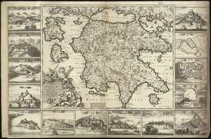
Peloponnesus hodie Moreae Regnum : distincté divisum in omnes suas provincias, hodiernas atque veteres, cui et adiuguntur...
6216.
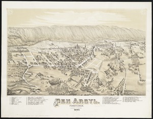
Pen Argyl : Pennsylvania
6217.
Penacook, N.H
6218.
Pend Oreille National Forest, Idaho
6219.
Pennsylvania
6220.
Pennsylvania
‹ Prev
Next ›
1
2
…
307
308
309
310
311
312
313
314
315
…
443
444