Toggle navigation
LMEC Home
Exhibitions
Georeferencing
Tools for Teachers
Collections
My Favorites
Sign Up / Log In
Search
Search the map portal
Map Collection
Map Collection
Map Sets
Search
Search
Search for
Search In
All Fields
Creator
Title
Subject
Place
Search All Digital Collections
Advanced Search
109 Results
My Search
Start Over
More Like
commonwealth:25152m08g
Remove constraint More Like: commonwealth:25152m08g
Place
Worcester (county)
Remove constraint Place: Worcester (county)
Filter your Search
Place
North and Central America
109
United States
109
Worcester (county)
[remove]
109
Massachusetts
55
New Braintree
3
Petersham
3
Warren
3
Westminster
3
more
Place
»
Date
Date range begin
–
Date range end
Current results range from
1794
to
1838
1794 : 1839
1794
1839
View distribution
Creator
Pratt, David
3
Ruggles, Gardner
3
Freeman, Barlow
2
Holman, Silas, 1760-1846
2
Keach, Zephaniah
2
Keyes, Silas
2
Lamb, Jason
2
Lee, David
2
more
Creator
»
Format
Maps/Atlases
109
Georeferenced
No
109
Collection
Town plans, 1830
60
Town plans, 1794
49
Available to use
No known restrictions
109
Search Constraints
Sort by relevance
relevance
title
date (asc)
date (desc)
Number of results to display per page
20 per page
10
per page
20
per page
50
per page
100
per page
View results as:
grid view
map view
Search Results
1.
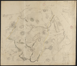
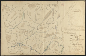
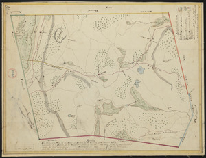
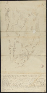
Plan of Ashburnham surveyed by Matthias Mossman, dated 1794-5.
2.
Plan of Ashburnham, surveyor's name not given, dated October, 1830
3.
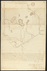
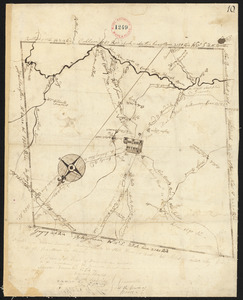
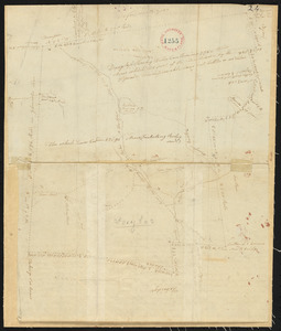
Plan of Athol, surveyor's name not given, dated April 27, 1795.
4.
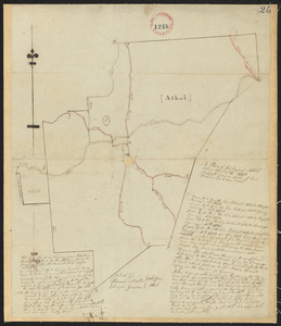
Plan of Athol, surveyor's name not given, dated September 1830
5.
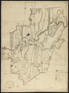
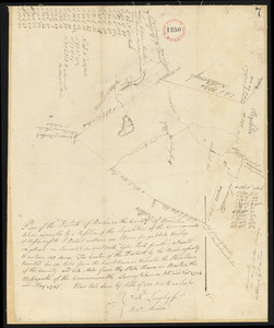
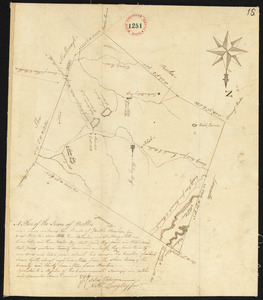
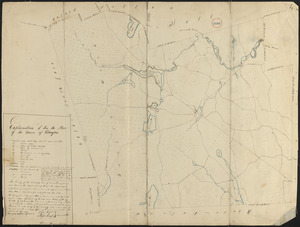
Plan of Barre made by David Lee and Samuel Lee, dated June 1830
6.
Plan of Barre surveyor's name not given, dated December, 1794.
7.
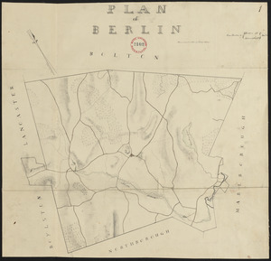
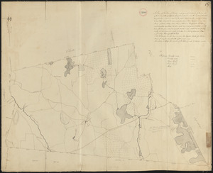
Plan of Berlin made by Henry Wilder, dated June 1830
8.
Plan of Berlin, made by Nathaniel Longley Jr., dated May, 1795.
9.
Plan of Bolton made by Silas Holman, dated 1830
10.
Plan of Bolton surveyed by Nathaniel Longley Jr., dated November 1794.
11.
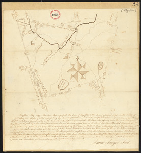
Plan of Boylston made by Aaron Sawyer, Jr. dated May, 1795.
12.
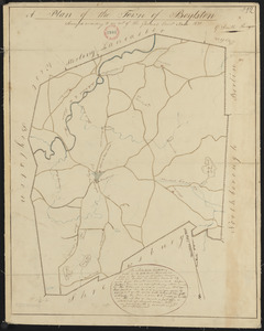
Plan of Boylston made by G. Smith dated 1830
13.
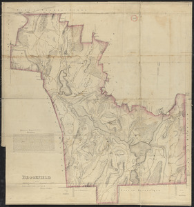
Plan of Brookfield made by Herman Stebbins dated 1830
14.
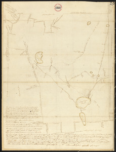
Plan of Brookfield surveyed by Thomas Hale Jr., dated November, 1794.
15.
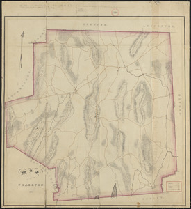
Plan of Charlton made by Barlow Freeman, dated 1831
16.
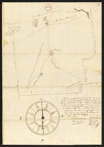
Plan of Charlton surveyor's name not given, dated May 22, 1795.
17.
Plan of Dana made by Ephraim Whipple, dated May 18, 1831
18.
Plan of Douglas, made by Aaron Marsh, dated 1794-5.
19.
Plan of Douglas made by Warren Humes, dated October 20, 1831
20.
Plan of Dudley made by Zephaniah Keach, dated February 28, 1831
‹ Prev
Next ›
1
2
3
4
5
6