Toggle navigation
LMEC Home
Exhibitions
Georeferencing
Tools for Teachers
Collections
My Favorites
Sign Up / Log In
Search
Search the map portal
Map Collection
Map Collection
Map Sets
Search
Search
Search for
Search In
All Fields
Creator
Title
Subject
Place
Search All Digital Collections
Advanced Search
77 Results
My Search
Start Over
More Like
commonwealth:2227nm63n
Remove constraint More Like: commonwealth:2227nm63n
Place
Middlesex (county)
Remove constraint Place: Middlesex (county)
Filter your Search
Place
Middlesex (county)
[remove]
77
North and Central America
77
United States
77
Massachusetts
40
Chelmsford
3
Acton
2
Ashby
2
Bedford
2
more
Place
»
Date
Date range begin
–
Date range end
Current results range from
1794
to
1831
1794 : 1832
1794
1832
View distribution
Creator
Hales, John Groves
20
French, Fred
4
Thompson, Samuel
4
Butler, Caleb
3
Brown, Jabez
2
Gray, John
2
Kingsbury, Jonathan
2
Metcalf, Matthew
2
more
Creator
»
Format
Maps/Atlases
77
Georeferenced
No
77
Collection
Town plans, 1830
41
Town plans, 1794
36
Available to use
No known restrictions
77
Search Constraints
Sort by relevance
relevance
title
date (asc)
date (desc)
Number of results to display per page
20 per page
10
per page
20
per page
50
per page
100
per page
View results as:
grid view
map view
Search Results
1.
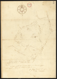
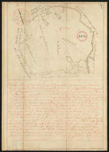
Plan of Acton, made by Jabez Brown, dated November, 1794.
2.
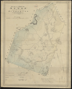
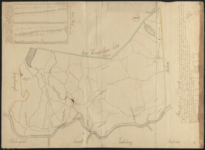
Plan of Acton made by John G. Hales, dated 1831
3.
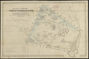
Plan of Arlington (West Cambridge) made by John G. Hales, dated August 1830
4.
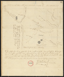
Plan of Ashby, surveyor's name not given , dated 1794.
5.
Plan of Ashby, surveyor's name not given, dated 1830
6.
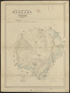
Plan of Bedford made by John G. Hales, dated 1830
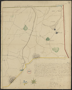
7.
Plan of Bedford, surveyor's name not given, dated 1794-5.
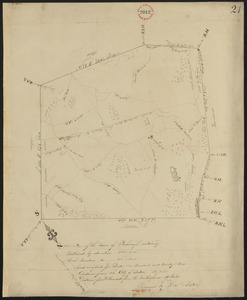
8.
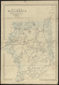
Plan of Billerica made by John G. Hales, dated 1831
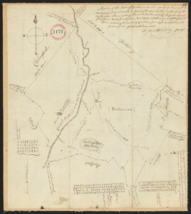
9.
Plan of Billerica, made by Samuel Whiting, dated November, 1794.
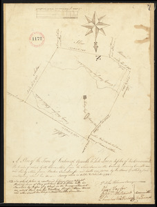
10.
Plan of Boxborough made by Hoar and Foster, dated September 1, 1831
11.
Plan of Boxborough made by Silas Holman, dated November, 1794.
12.
Plan of Burlington made by Bartholomew Richardson, dated October, 1831
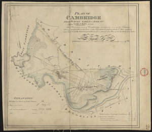
13.
Plan of Cambridge made by John G. Hales, dated June 1830
14.
Plan of Cambridge, made by Samuel Thompson, dated April, 1795.
15.
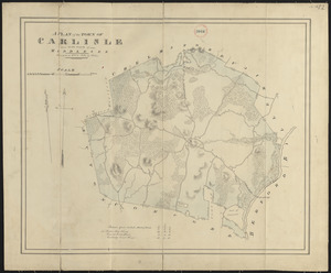
Plan of Carlisle made by John G. Hales, dated 1831
16.
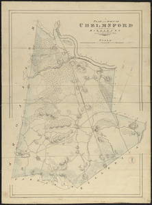
Plan of Chelmsford made by John G. Hales, dated 1831
17.
Plan of Concord, made by Ephraim Wood, dated 1794-5.
18.
Plan of Concord made by John G. Hales, dated 1830
19.
Plan of District of Carlisle, surveyor's name not given, dated 1794-5.
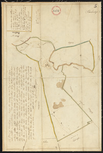
20.
Plan of Dracut made by B. F. Varnum, dated October 31, 1831
+
-
Redo search here
Search when I move the map
Leaflet
| ©
OpenStreetMap
contributors, ©
CartoDB
‹ Prev
Next ›
1
2
3
4