Toggle navigation
LMEC Home
Exhibitions
Georeferencing
Tools for Teachers
Collections
My Favorites
Sign Up / Log In
Search
Search the map portal
Map Collection
Map Collection
Map Sets
Search
Search
Search for
Search In
All Fields
Creator
Title
Subject
Place
Search All Digital Collections
Advanced Search
127 Results
My Search
Start Over
More Like
commonwealth:2227nq417
Remove constraint More Like: commonwealth:2227nq417
Place
Maine
Remove constraint Place: Maine
Filter your Search
Place
Maine
[remove]
127
North and Central America
127
United States
127
Cumberland (county)
19
York (county)
19
Oxford (county)
16
Kennebec (county)
13
Lincoln (county)
10
more
Place
»
Date
Date range begin
–
Date range end
Current results range from
1786
to
1798
1786 : 1799
1786
1799
View distribution
Creator
Ballard, Ephraim
7
Carleton, Osgood, 1742-1816
6
Merrill, Nathaniel
4
Moore Sylvester
4
Peters, John
4
Boyd, Thomas
3
Banks, Moses
2
Bowden, Michel
2
more
Creator
»
Format
Maps/Atlases
127
Georeferenced
No
127
Collection
Town plans, 1794
127
Available to use
No known restrictions
127
Search Constraints
Sort by relevance
relevance
title
date (asc)
date (desc)
Number of results to display per page
20 per page
10
per page
20
per page
50
per page
100
per page
View results as:
grid view
map view
Search Results
1.
Plan of Alfred surveyed by Michel Bowden dated May 29, 1795.
2.
Plan of Ballstown (Jefferson and Whitefield) surveyed by William Davis, dated May 20, 1795.
3.
Plan of Bangor made by Elihu Warner, dated October 20, 1795.
4.
Plan of Bath, Me, made by Dummer Sewall, dated March 7, 1795.
5.
Plan of Belfast surveyed by Alexander Clark, dated 1794.
6.
Plan of Berwick surveyor's name not given, dated February 13, 1795.
7.
Plan of Bethel (Sudbury Canada) made by Eli Twitchell, dated December 18, 1795.
8.
Plan of Biddeford, made by Partridge Richardson, dated 1794.
9.
Plan of Blue Hill made by John Peters, dated 1794.
10.
Plan of Boothbay made by Thomas Boyd, dated May 20, 1795.
11.
Plan of Bowdoin made by James Shurtleff dated 1794-5.
12.
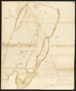
Plan of Bowdoinham made by Ephraim Ballard and Sylverster J. Moore, dated April, 1795.
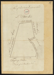
13.
Plan of Bradley's and Eastman's Land (Stow, Me) surveyor's name not given, dated 1794-1795.
14.
Plan of Bridgeton surveyed by Benjamin Kimball, Jr, dated May 21, 1795.
15.
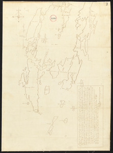
Plan of Bristol (Pemaquid) surveyed by Thomas Boyd, dated June 20, 1795.
16.
Plan of Brownfield (Prescott's Grant) made by Nathaniel Merrill, dated December 1795.
17.
Plan of Brunswick, made by Daniel Given, dated May 20, 1795
18.
Plan of Buckfield surveyed by Thomas Joselyn, dated by 1794-5.
19.
Plan of Bucksport, surveyed by Osgood Carleton, dated 1787.
20.
Plan of Buxton, surveyor's name not given, dated June 10, 1795.
‹ Prev
Next ›
1
2
3
4
5
6
7