Toggle navigation
LMEC Home
Exhibitions
Georeferencing
Tools for Teachers
Collections
My Favorites
Sign Up / Log In
Search
Search the map portal
Map Collection
Map Collection
Map Sets
Search
Search
Search for
Search In
All Fields
Creator
Title
Subject
Place
Search All Digital Collections
Advanced Search
61 Results
My Search
Start Over
More Like
commonwealth:2227nh207
Remove constraint More Like: commonwealth:2227nh207
Place
Franklin (county)
Remove constraint Place: Franklin (county)
Filter your Search
Place
Franklin (county)
[remove]
61
North and Central America
61
United States
61
Massachusetts
29
Maine
5
Colrain
3
Hawley
3
Rowe
3
more
Place
»
Date
Date range begin
–
Date range end
Current results range from
1793
to
1839
1793 : 1840
1793
1840
View distribution
Creator
Darling, E. S.
4
Leonard, Levi
4
Gould, Josiah
3
Hoyt, Arthur W.
3
Tobey, John
3
Blake, Jonathan, Jr.
2
Bowman, William
2
Farnsworth, E. P.
2
more
Creator
»
Format
Maps/Atlases
61
Georeferenced
No
61
Collection
Town plans, 1794
31
Town plans, 1830
30
Available to use
No known restrictions
61
Search Constraints
Sort by relevance
relevance
title
date (asc)
date (desc)
Number of results to display per page
20 per page
10
per page
20
per page
50
per page
100
per page
View results as:
grid view
map view
Search Results
1.
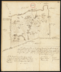
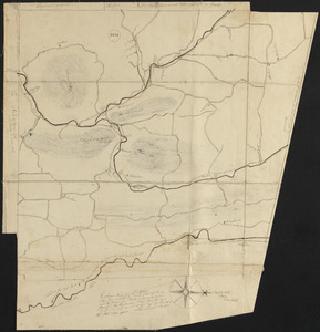
Plan of Ashfield made by Levi Leonard, dated December 25, 1830
2.
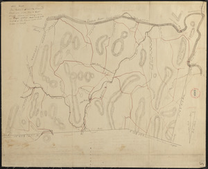
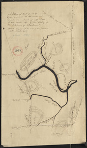
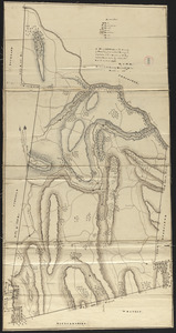
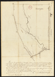
Plan of Ashfield, surveyor's name not given, dated May 27, 1795.
3.
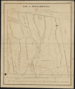
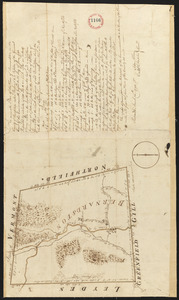
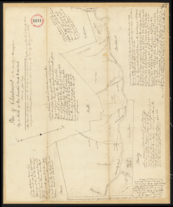
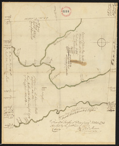
Plan of Bernardston made by Henry W. Cushman, dated October, 1830
4.
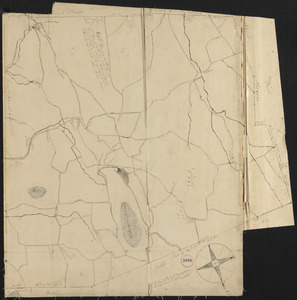
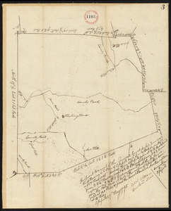
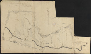
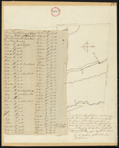
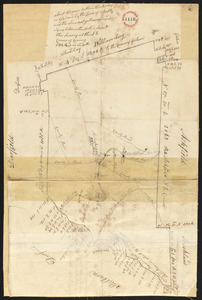
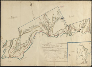
Plan of Bernardston, surveyor's name not given, dated November, 1794.
5.
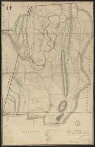
Plan of Buckland made by John Tobey, dated December 1830
6.
Plan of Buckland made by Samuel Taylor dated December, 1794.
7.
Plan of Charlemont made by Levi Leonard, dated September 1830
8.
Plan of Charlemont surveyed by Jesse King, dated 1794-5.
9.
Plan of Charlemont (Zoar) made by John Tobey, dated June 1839
10.
Plan of Colrain made by Levi Leonard, dated November 29, 1830
11.
Plan of Colrain made by Phineas Munn, dated October, 1794.
12.
Plan of Colrain, surveyor's name not given, dated May, 1798.
13.
Plan of Conway made by Arthur W. Hoyt, dated 1830
14.
Plan of Conway, surveyor's name not given, dated November, 1794.
15.
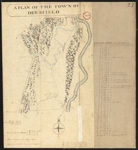
Plan of Deerfield made by Arthur W. Hoyt, dated 1830
16.
Plan of Deerfield surveyed by D. Hoit, Jr. dated December 1794.
17.
Plan of Erving's Grant (Erving), surveyor's name not given, dated October 1830
18.
Plan of Farmington, made by Lemuel Perham, dated May, 1795.
19.
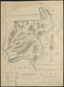
Plan of Gill made by Josiah Gould, dated 1830
20.
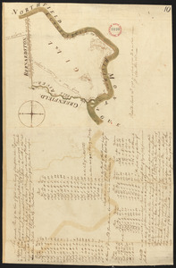
Plan of Gill, made by Seba Allen, dated November, 1794.
+
-
Redo search here
Search when I move the map
Leaflet
| ©
OpenStreetMap
contributors, ©
CartoDB
‹ Prev
Next ›
1
2
3
4