Toggle navigation
LMEC Home
Exhibitions
Georeferencing
Tools for Teachers
Collections
My Favorites
Sign Up / Log In
Search
Search the map portal
Map Collection
Map Collection
Map Sets
Search
Search
Search for
Search In
All Fields
Creator
Title
Subject
Place
Search All Digital Collections
Advanced Search
1 Results
My Search
Start Over
More Like
commonwealth:r781wp633
Remove constraint More Like: commonwealth:r781wp633
Topic
Planning
Remove constraint Topic: Planning
Filter your Search
Place
Andover
1
Essex (county)
1
North and Central America
1
United States
1
Topic
Land use
1
Phillips Academy
1
Planning
[remove]
1
Real property
1
Date
1912
1
Creator
Olmsted Brothers
1
Format
Maps/Atlases
1
Georeferenced
Yes
1
Collection
Campus Maps from Phillips Academy Archives and Special Collections
1
Search Constraints
Sort by relevance
relevance
title
date (asc)
date (desc)
Number of results to display per page
20 per page
10
per page
20
per page
50
per page
100
per page
View results as:
grid view
map view
Search Results
1.
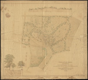
Phillips Academy, Andover, Mass. : plan for development of lands lying between Bartlett, Morton and Highland Sts.