Toggle navigation
LMEC Home
Exhibitions
Georeferencing
Tools for Teachers
Collections
My Favorites
Sign Up / Log In
Search
Search the map portal
Map Collection
Map Collection
Map Sets
Search
Search
Search for
Search In
All Fields
Creator
Title
Subject
Place
Search All Digital Collections
Advanced Search
3 Results
My Search
Start Over
More Like
commonwealth-oai:2r36zw60c
Remove constraint More Like: commonwealth-oai:2r36zw60c
Available to use
No known restrictions
Remove constraint Available to use: No known restrictions
Filter your Search
Place
New York
3
North and Central America
3
United States
3
Long Island
1
Suffolk (county)
1
Topic
Long Island (N.Y.)--Maps
3
Landowners--New York (State)--Suffolk County--Maps
1
Long Island (N.Y.)--History--Maps
1
New England--Maps
1
New York (State)--Maps
1
Postal service--United States--Maps
1
Railroads--New England--Maps
1
Railroads--New York (State)--Maps
1
more
Topic
»
Date
Date range begin
–
Date range end
Current results range from
1858
to
1933
1858 : 1934
1858
1934
View distribution
Creator
Billboard Barn
1
Chace, J.
1
Foster, Richard
1
Miller, George C.
1
Nicholson, Walter L.
1
Smith, Courtland
1
Format
Maps/Atlases
3
Georeferenced
No
3
Collection
Norman B. Leventhal Map & Education Center Collection
3
Boston and New England Maps
1
Available to use
No known restrictions
[remove]
3
Search Constraints
Sort by relevance
relevance
title
date (asc)
date (desc)
Number of results to display per page
20 per page
10
per page
20
per page
50
per page
100
per page
View results as:
grid view
map view
Search Results
1.
A map of Long Island
2.
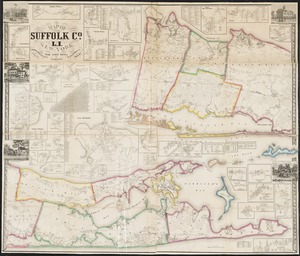
Map of Suffolk Co., L.I., New York : from actual surveys
3.
Post route map of the states of New Hampshire, Vermont, Massachusetts, Rhode Island, Connecticut, and parts of New York and Maine