Toggle navigation
LMEC Home
Exhibitions
Georeferencing
Tools for Teachers
Collections
My Favorites
Sign Up / Log In
Search
Search the map portal
Map Collection
Map Collection
Map Sets
Search
Search
Search for
Search In
All Fields
Creator
Title
Subject
Place
Search All Digital Collections
Advanced Search
3 Results
My Search
Start Over
More Like
commonwealth:6d570g14r
Remove constraint More Like: commonwealth:6d570g14r
Creator
United States. Army Map Service
Remove constraint Creator: United States. Army Map Service
Filter your Search
Place
Africa
1
Asia
1
Espíritu Santo
1
Euphrates
1
National Capital
1
New Britain
1
Oceania
1
Papua New Guinea
1
more
Place
»
Topic
Aeronautics
3
Islands
1
Rivers
1
Date
Date range begin
–
Date range end
Current results range from
1942
to
1946
1942 : 1947
1942
1947
View distribution
Creator
United States. Army Air Forces
3
United States. Army Map Service
[remove]
3
Great Britain. Army. East African Survey Group
1
United States. Aeronautical Chart Service
1
Format
Maps/Atlases
3
Georeferenced
No
3
Collection
Ralph Finos Map Collection at Phillips Academy
3
Available to use
No known restrictions
3
Search Constraints
Sort by relevance
relevance
title
date (asc)
date (desc)
Number of results to display per page
20 per page
10
per page
20
per page
50
per page
100
per page
View results as:
grid view
map view
Search Results
1.
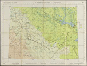
Euphrates River AAF aeronautical chart
2.
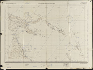
Solomon Islands long range air navigation chart
3.
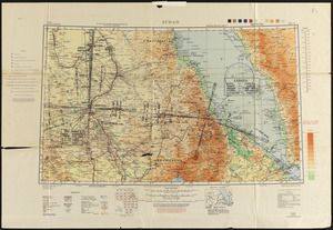
Sudan
+
-
Redo search here
Search when I move the map
Leaflet
| ©
OpenStreetMap
contributors, ©
CartoDB