Toggle navigation
LMEC Home
Exhibitions
Georeferencing
Tools for Teachers
Collections
My Favorites
Sign Up / Log In
Search
Search the map portal
Map Collection
Map Collection
Map Sets
Search
Search
Search for
Search In
All Fields
Creator
Title
Subject
Place
Search All Digital Collections
Advanced Search
9 Results
My Search
Start Over
More Like
commonwealth:z603vt78z
Remove constraint More Like: commonwealth:z603vt78z
Format
Drawings/Illustrations
Remove constraint Format: Drawings/Illustrations
Filter your Search
Place
North and Central America
9
United States
9
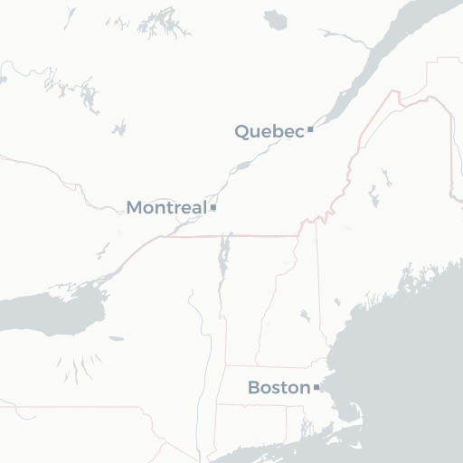
Boston
8
Suffolk (county)
8
Newport
1
Newport (county)
1
Rhode Island
1
Topic
Boston (Mass.)--History--Revolution, 1775-1783--Aerial views--Early works to 1800
5
Boston (Mass.)--History--Siege, 1775-1776--Aerial views--Early works to 1800
5
Boston (Mass.)--Pictorial works--Early works to 1800
5
Sieges--Massachusetts--Boston--Pictorial works--Early works to 1800
5
Boston (Mass.)--History--Revolution, 1775-1783--Maps--Early works to 1800
3
Boston (Mass.)--History--Siege, 1775-1776--Maps--Early works to 1800
2
Newport (R.I.)--History--18th century--Pictorial works--Early works to 1800
1
Newport (R.I.)--Pictorial works--Early works to 1800
1
Date
Date range begin
–
Date range end
Current results range from
1775
to
1780
1775 : 1781
1775
1781
View distribution
Creator
Williams, Richard, active 1750-1776
8
Format
Drawings/Illustrations
[remove]
9
Manuscripts
9
Georeferenced
No
9
Collection
American Revolutionary War-Era Maps
9
Richard H. Brown Revolutionary War Map Collection at Mount Vernon
9
Available to use
Creative Commons license
9
Search Constraints
Sort by relevance
relevance
title
date (asc)
date (desc)
Number of results to display per page
20 per page
10
per page
20
per page
50
per page
100
per page
View results as:
grid view
map view
Search Results
1.
[Boston Neck, with the British lines and John Hancock's house]
2.
[Cambridge with Washington's headquarters]
3.
[Charlestown Promontory, the ruins of the town after the Battle of Bunker Hill and General Howe's encampment]
4.
[Dorchester Neck]
5.
[Noddle Island and the Mill Pond]
6.
[Panoramic view of Newport, Rhode Island and the harbor showing the position of the French fleet and troop encampments]
7.
[The burnt ruins of Charlestown from across the Charles River]
8.
[Troops on parade, the Charles River and Castle Island]
9.
[View of the Charles River]
+
-
Redo search here
Search when I move the map
Leaflet
| ©
OpenStreetMap
contributors, ©
CartoDB
![[Boston Neck, with the British lines and John Hancock's house]](https://bpldcassets.blob.core.windows.net/derivatives/images/commonwealth:dz010v61c/image_thumbnail_300.jpg)
![[Cambridge with Washington's headquarters]](https://bpldcassets.blob.core.windows.net/derivatives/images/commonwealth:dz010v63x/image_thumbnail_300.jpg)
![[Charlestown Promontory, the ruins of the town after the Battle of Bunker Hill and General Howe's encampment]](https://bpldcassets.blob.core.windows.net/derivatives/images/commonwealth:dz010v65g/image_thumbnail_300.jpg)
![[Dorchester Neck]](https://bpldcassets.blob.core.windows.net/derivatives/images/commonwealth:dz010v59b/image_thumbnail_300.jpg)
![[Noddle Island and the Mill Pond]](https://bpldcassets.blob.core.windows.net/derivatives/images/commonwealth:dz010v671/image_thumbnail_300.jpg)
![[Panoramic view of Newport, Rhode Island and the harbor showing the position of the French fleet and troop encampments]](https://bpldcassets.blob.core.windows.net/derivatives/images/commonwealth:dz010v493/image_thumbnail_300.jpg)
![[The burnt ruins of Charlestown from across the Charles River]](https://bpldcassets.blob.core.windows.net/derivatives/images/commonwealth:dz010v71m/image_thumbnail_300.jpg)
![[Troops on parade, the Charles River and Castle Island]](https://bpldcassets.blob.core.windows.net/derivatives/images/commonwealth:dz010v69k/image_thumbnail_300.jpg)
![[View of the Charles River]](https://bpldcassets.blob.core.windows.net/derivatives/images/commonwealth:dz010v735/image_thumbnail_300.jpg)