Toggle navigation
LMEC Home
Exhibitions
Georeferencing
Tools for Teachers
Collections
My Favorites
Sign Up / Log In
Search
Search the map portal
Map Collection
Map Collection
Map Sets
Search
Search
Search for
Search In
All Fields
Creator
Title
Subject
Place
Search All Digital Collections
Advanced Search
7 Results
My Search
Start Over
More Like
commonwealth:6w924p949
Remove constraint More Like: commonwealth:6w924p949
Collection
MacLean Collection Map Library
Remove constraint Collection: MacLean Collection Map Library
Filter your Search
Place
North and Central America
7
United States
7
Virginia
6
Maryland
3
Delaware
2
Pennsylvania
2
North Carolina
1
South Carolina
1
more
Place
»
Topic
Virginia--Maps--Early works to 1800
6
Maryland--Maps--Early works to 1800
3
Delaware--Maps--Early works to 1800
2
Pennsylvania--Maps--Early works to 1800
2
North Carolina--Maps--Early works to 1800
1
Roads--Pennsylvania--Maps--Early works to 1800
1
South Carolina--Maps--Early works to 1800
1
Washington, George, 1732-1799
1
more
Topic
»
Date
Date range begin
–
Date range end
Current results range from
1754
to
1789
1754 : 1790
1754
1790
View distribution
Creator
American Philosophical Society
1
Bowles, Carington, 1724-1793
1
Bowles, John, 1701-1779
1
Cheevers, J. (John)
1
Evans, Lewis, 1700?-1756
1
Fisher, Thomas, 1741-1810
1
Fry, Joshua, approximately 1700-1754
1
Hutchins, Thomas, 1730-1789
1
more
Creator
»
Format
Maps/Atlases
7
Georeferenced
No
7
Collection
American Revolutionary War-Era Maps
7
MacLean Collection Map Library
[remove]
7
Search Constraints
Sort by relevance
relevance
title
date (asc)
date (desc)
Number of results to display per page
20 per page
10
per page
20
per page
50
per page
100
per page
View results as:
grid view
map view
Search Results
1.
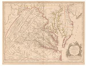
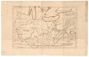
Carte de la Virginie et du Maryland
2.
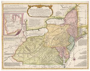
A general map of the Middle British Colonies in America viz. Virginia, Maryland, Delaware, Pensilvania, New-Jersey New York,...
3.
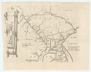
Map of part of Pennsylvania & Maryland intended to illustrate proposals for a communication between the waters of the Delaware...
4.
A map of the country between Albemarle Sound, and Lake Erie, comprehending the whole of Virginia, Maryland, Delaware and...
5.
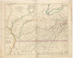
Map of the western parts of the colony of Virginia as far as the Mississipi
6.
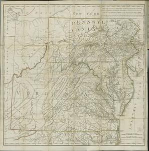
A new map of the western parts of Virginia, Pennsylvania, Maryland and North Carolina : comprehending the river Ohio, and all...
7.
Partie meridionale des possessions angloise en Amerique