Toggle navigation
LMEC Home
Exhibitions
Georeferencing
Tools for Teachers
Collections
My Favorites
Sign Up / Log In
Search
Search the map portal
Map Collection
Map Collection
Map Sets
Search
Search
Search for
Search In
All Fields
Creator
Title
Subject
Place
Search All Digital Collections
Advanced Search
2511 Results
My Search
Start Over
boston atlas
Remove constraint boston atlas
Filter your Search
Place
North and Central America
1,373
United States
834
Europe
458
Massachusetts
349
South America
189
Asia
188
Canada
187
Suffolk (county)
161
more
Place
»
Topic
Landowners--Massachusetts--Boston--Maps
115
Real property--Massachusetts--Boston--Maps
106
United States--Maps
85
Boston (Mass.)--Maps
64
Nautical charts--Early works to 1800
39
Buildings--Massachusetts--Boston--Maps
34
Elections--United States--Maps
34
Nova Scotia--Maps--Early works to 1800
33
more
Topic
»
Date
Date range begin
–
Date range end
Current results range from
1482
to
2023
View distribution
Creator
United States. Hydrographic Office
583
Des Barres, Joseph F. W. (Joseph Frederick Wallet), 1722-1824
116
Ptolemy, 2nd cent
100
Bromley, George Washington
86
Bromley, Walter Scott
84
Carey, Mathew, 1760-1839
72
Paullin, Charles Oscar, 1868 or 1869-1944
70
United States Exploring Expedition (1838-1842)
70
more
Creator
»
Format
Maps/Atlases
2,502
Books
34
Manuscripts
13
Prints
8
Drawings/Illustrations
1
Georeferenced
Yes
133
No
2,378
Collection
Norman B. Leventhal Map & Education Center Collection
2,410
Maritime Charts and Atlases
1,129
Boston and New England Maps
382
American Revolutionary War-Era Maps
285
Urban Maps
255
Massachusetts Real Estate Atlases
72
Mapping Boston Collection
61
Applied Geographics, Inc. Records
23
more
Collection
»
Available to use
No known restrictions
2,277
Creative Commons license
73
Search Constraints
Sort by relevance
relevance
title
date (asc)
date (desc)
Number of results to display per page
20 per page
10
per page
20
per page
50
per page
100
per page
View results as:
grid view
map view
Search Results
161.
Atlas of Middlesex County, Massachusetts, volume 3 : towns of Ashland, Framingham, Holliston, Hopkinton, Natick, Sherborn,...
162.
Atlas of the town of Marblehead, Massachusetts : based on plans in the office of the Board of Assessors
163.
Atlas of the city of Newton Massachusetts : assessors block system
164.
Atlas of the city of Salem, Massachusetts : from actual survey and official records
165.
Atlas of the city of Cambridge, Massachusetts : from actual surveys and official plans
166.
Atlas of the city of Cambridge, Massachusetts : from actual surveys and official plans
167.
Atlas of the city of Cambridge, Massachusetts : from actual surveys and official plans
168.
Atlas of the city of Cambridge, Massachusetts : from official records, private plan and actual surveys
169.
Atlas of the city of Cambridge, Massachusetts : from actual surveys and official plans
170.
Atlas of the city of Newton, Massachusetts : from actual surveys and official plans
171.
Atlas of the city of Newton, Massachusetts : from actual surveys and official plans
172.
Atlas of the city of Newton, Massachusetts
173.
Atlas of the city of Newton, Massachusetts : compiled from actual surveys and records
174.
Atlas of the city of Somerville, Massachusetts : from actual surveys and official plans
175.
Atlas of the city of Somerville, Massachusetts : from actual surveys and official records
176.
Atlas of the town of Beverly, Massachusetts : from official records, private plans and actual surveys
177.
Atlas of the town of Brookline, Massachusetts : from official records, private plans and actual surveys
178.
Atlas of the town of Brookline, Massachusetts : from actual surveys & official records
179.
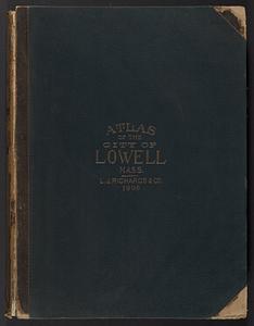
Atlas of the City of Lowell, Massachusetts : based upon and carefully compiled from the triangulation surveys, and maps in the...
180.
Atlas of the city of Lynn, Massachusetts : including, also, the towns of Swampscott and Saugus : based upon, and carefully...
‹ Prev
Next ›
1
2
…
5
6
7
8
9
10
11
12
13
…
125
126