Toggle navigation
LMEC Home
Exhibitions
Georeferencing
Tools for Teachers
Collections
My Favorites
Sign Up / Log In
Search
Search the map portal
Map Collection
Map Collection
Map Sets
Search
Search
Search for
Search In
All Fields
Creator
Title
Subject
Place
Search All Digital Collections
Advanced Search
13647 Results
Filter your Search
Place
North and Central America
10,313
United States
8,444
Massachusetts
2,784
Suffolk (county)
1,677
Boston
1,633
Europe
1,413
Canada
950
New York
648
more
Place
»
Topic
Boston (Mass.)--Maps
747
City planning--Massachusetts--Boston--Maps
418
United States--History--Revolution, 1775-1783--Maps
329
United States--Maps
321
Real property--Massachusetts--Boston--Maps
254
Urban renewal--Massachusetts--Boston--Maps
254
Massachusetts--Maps
231
Insurance surveys
197
more
Topic
»
Date
Date range begin
–
Date range end
Current results range from
1482
to
2023
View distribution
Creator
United States. Hydrographic Office
597
Boston Redevelopment Authority
404
Des Barres, Joseph F. W. (Joseph Frederick Wallet), 1722-1824
247
Royal United Services Institute for Defence and Security Studies
160
Jefferys, Thomas, -1771
154
George, III, King of Great Britain, 1738-1820
152
George, IV, King of Great Britain, 1762-1830
151
O.H. Bailey & Co
148
more
Creator
»
Format
Maps/Atlases
13,466
Manuscripts
985
Prints
102
Books
49
Drawings/Illustrations
44
Photographs
15
Objects/Artifacts
13
Documents
7
more
Format
»
Georeferenced
Yes
979
No
12,668
Collection
Norman B. Leventhal Map & Education Center Collection
9,088
American Revolutionary War-Era Maps
3,305
Boston and New England Maps
2,908
Urban Maps
2,465
Maritime Charts and Atlases
1,169
William L. Clements Library Collection
910
Library of Congress Collection
618
Boston Redevelopment Authority Collection
475
more
Collection
»
Available to use
No known restrictions
10,214
Creative Commons license
1,677
Search Constraints
Sort by relevance
relevance
title
date (asc)
date (desc)
Number of results to display per page
20 per page
10
per page
20
per page
50
per page
100
per page
View results as:
grid view
map view
Search Results
13101.
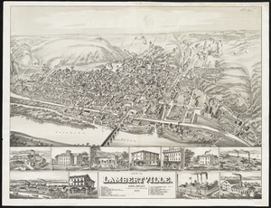
View of Lambertville, New Jersey
13102.
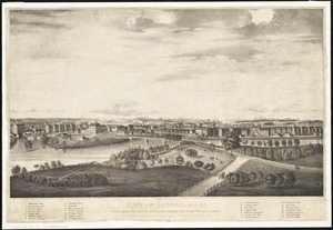
View of Lowell, Mass : taken from the house of Elisha Fuller Esq. in Dracut
13103.
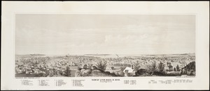
View of Lynn, Mass. in 1849 : from High Rock
13104.
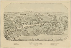
View of Madison, Conn : 1881
13105.
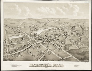
View of Mansfield, Mass : 1879
13106.
View of Marlborough, Mass : 1879
13107.
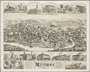
View of Medway, Massachusetts : 1887
13108.
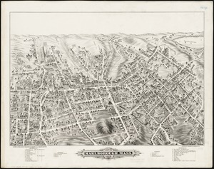
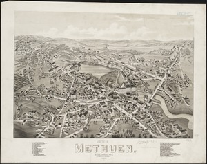
View of Methuen, Massachusetts : 1882
13109.
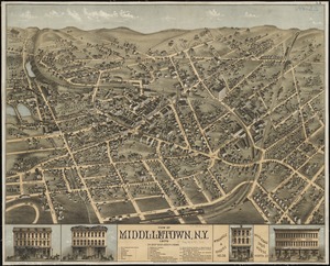
View of Middletown, N.Y : 1874
13110.
View of Milford, Conn : 1882
13111.
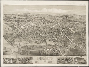
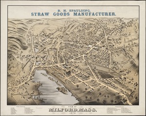
View of Milford, Mass : 1876
13112.
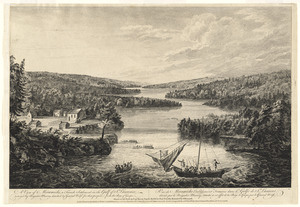
A view of Miramichi, a French settlement in the Gulf of St. Laurence, destroyed by Brigadier Murray detached by General Wolfe...
13113.
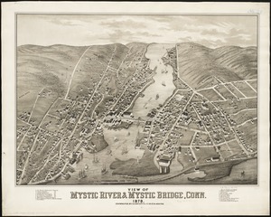
View of Mystic River & Mystic Bridge, Conn. 1879
13114.
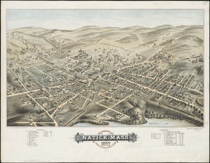
View of Natick, Mass : 1877, population about 8000
13115.
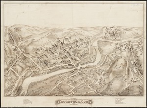
View of Naugatuck, Conn : 1877
13116.
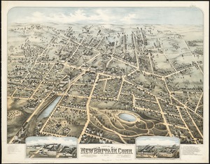
View of New Britain, Conn : 1875
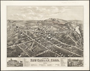
13117.
View of New Canaan, Conn : 1878
13118.
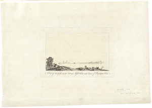
A view of New Castle with the fort and light house on the entrance of Piscataqua River
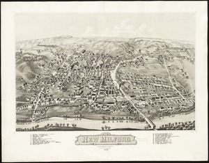
13119.
View of New Milford, Conn : 1882
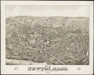
13120.
View of Newton, Mass : comprising Wards 1 & 7 & environs of the city of Newton
‹ Prev
Next ›
1
2
…
652
653
654
655
656
657
658
659
660
…
682
683