Toggle navigation
LMEC Home
Exhibitions
Georeferencing
Tools for Teachers
Collections
My Favorites
Sign Up / Log In
Search
Search the map portal
Map Collection
Map Collection
Map Sets
Search
Search
Search for
Search In
All Fields
Creator
Title
Subject
Place
Search All Digital Collections
Advanced Search
13518 Results
Filter your Search
Place
North and Central America
10,232
United States
8,367
Massachusetts
2,778
Suffolk (county)
1,675
Boston
1,631
Europe
1,386
Canada
949
New York
640
more
Place
»
Topic
Boston (Mass.)--Maps
746
City planning--Massachusetts--Boston--Maps
418
United States--History--Revolution, 1775-1783--Maps
329
United States--Maps
321
Real property--Massachusetts--Boston--Maps
254
Urban renewal--Massachusetts--Boston--Maps
254
Massachusetts--Maps
230
Insurance surveys
197
more
Topic
»
Date
Date range begin
–
Date range end
Current results range from
1482
to
2023
View distribution
Creator
United States. Hydrographic Office
596
Boston Redevelopment Authority
404
Des Barres, Joseph F. W. (Joseph Frederick Wallet), 1722-1824
247
Royal United Services Institute for Defence and Security Studies
160
Jefferys, Thomas, -1771
154
George, III, King of Great Britain, 1738-1820
152
George, IV, King of Great Britain, 1762-1830
151
O.H. Bailey & Co
148
more
Creator
»
Format
Maps/Atlases
13,337
Manuscripts
985
Prints
102
Books
49
Drawings/Illustrations
44
Photographs
15
Objects/Artifacts
13
Documents
7
more
Format
»
Georeferenced
Yes
979
No
12,539
Collection
Norman B. Leventhal Map & Education Center Collection
9,022
American Revolutionary War-Era Maps
3,305
Boston and New England Maps
2,900
Urban Maps
2,425
Maritime Charts and Atlases
1,167
William L. Clements Library Collection
910
Library of Congress Collection
618
Boston Redevelopment Authority Collection
475
more
Collection
»
Available to use
No known restrictions
10,085
Creative Commons license
1,677
Search Constraints
Sort by relevance
relevance
title
date (asc)
date (desc)
Number of results to display per page
20 per page
10
per page
20
per page
50
per page
100
per page
View results as:
grid view
map view
Search Results
2401.
Clearwater Manufacturing Company (Finishing Plant), Clearwater, S.C. [insurance map]
2402.
Clemens' map of Pennsylvania
2403.
Clemens' silent teacher, dissected map of the United States and of each state in counties
2404.
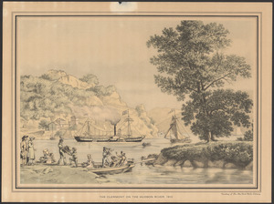
The Clermont on the Hudson River, 1810
2405.
[Cliftondale, Saugus and East Saugus, Massachusetts] : 1896
2406.
Climate zones for Eastern Asia
2407.
Clothing recommendations for travel in China
2408.
Clue plan for Collins' illustrated guide to London
2409.
Clyde, River Point and Arctic, Rhode Island
2410.
Coal areas of Canada
2411.
Coal fields of Alberta and British Columbia
2412.
Coal fields of Manitoba and Saskatchewan
2413.
Coal fields of Nova Scotia and New Brunswick
2414.
Coast and islands between Queen Charlotte Sound and Burke Channel, British Columbia
2415.
Coast chart no. 186 : Choctawhatchee Inlet to Pensacola Entrance, West Florida : report of Navy Yard Site Commission, Gulf of...
2416.
The coast from St. Johns, New Brunswick, to Goldsborough Bay, Maine
2417.
The coast of a part of New England, New York, New Jersey, Pensilvania, Maryland, Virginia, and part of North Carolina &c. with...
2418.
The coast of a part of North Carolina, South Carolina, Georgia and part of East Florida, with the bays, soundings, banks, roks,...
2419.
The coast of Florida from the Dry Tortugas to the old Cape
2420.
[Coast of Maine from Frenchman Bay to Mosquito Harbor]
‹ Prev
Next ›
1
2
…
117
118
119
120
121
122
123
124
125
…
675
676
![Clearwater Manufacturing Company (Finishing Plant), Clearwater, S.C. [insurance map]](https://bpldcassets.blob.core.windows.net/derivatives/images/commonwealth:2r36vc319/image_thumbnail_300.jpg)


![[Cliftondale, Saugus and East Saugus, Massachusetts]](https://bpldcassets.blob.core.windows.net/derivatives/images/commonwealth:x633fc53m/image_thumbnail_300.jpg)


![[Coast of Maine from Frenchman Bay to Mosquito Harbor]](https://bpldcassets.blob.core.windows.net/derivatives/images/commonwealth:cj82m295n/image_thumbnail_300.jpg)