Toggle navigation
LMEC Home
Exhibitions
Georeferencing
Tools for Teachers
Collections
My Favorites
Sign Up / Log In
Search
Search the map portal
Map Collection
Map Collection
Map Sets
Search
Search
Search for
Search In
All Fields
Creator
Title
Subject
Place
Search All Digital Collections
Advanced Search
2867 Results
My Search
Start Over
atlas
Remove constraint atlas
Filter your Search
Place
North and Central America
1,663
United States
1,001
Europe
464
Massachusetts
353
Canada
271
South America
191
Asia
190
Suffolk (county)
164
more
Place
»
Topic
Landowners--Massachusetts--Boston--Maps
115
Real property--Massachusetts--Boston--Maps
106
United States--Maps
87
Boston (Mass.)--Maps
64
United States--History--French and Indian War, 1754-1763--Maps
63
Saint Lawrence River--Maps
41
Nautical charts--Early works to 1800
39
North America--Maps--Early works to 1800
36
more
Topic
»
Date
Date range begin
–
Date range end
Current results range from
1482
to
2023
View distribution
Creator
United States. Hydrographic Office
583
Des Barres, Joseph F. W. (Joseph Frederick Wallet), 1722-1824
118
Ptolemy, 2nd cent
100
Bromley, George Washington
99
Bromley, Walter Scott
97
G.W. Bromley & Co.
75
Carey, Mathew, 1760-1839
74
Paullin, Charles Oscar, 1868 or 1869-1944
70
more
Creator
»
Format
Maps/Atlases
2,851
Manuscripts
58
Books
37
Prints
8
Documents
5
Drawings/Illustrations
1
Georeferenced
Yes
142
No
2,725
Collection
Norman B. Leventhal Map & Education Center Collection
2,410
Maritime Charts and Atlases
1,167
American Revolutionary War-Era Maps
504
Boston and New England Maps
382
Urban Maps
255
Massachusetts Real Estate Atlases
144
William L. Clements Library Collection
92
Mapping Boston Collection
61
more
Collection
»
Available to use
No known restrictions
2,316
Creative Commons license
158
Search Constraints
Sort by relevance
relevance
title
date (asc)
date (desc)
Number of results to display per page
20 per page
10
per page
20
per page
50
per page
100
per page
View results as:
grid view
map view
Search Results
2501.
Cumbria & Westmoria : vulgo Cumberland & Westmorland
2502.
A draught of a route from Québec to Fort Halifax on the River Kennebec and back again to Québec by the rivers Chaudière and...
2503.
Ducatus Eboracensis pars occidentalis = the Westriding of York Shire
2504.
Essexiae descriptio = The description of Essex
2505.
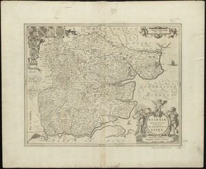
Exactissima Regni Scotiae tabula tam in septentrionalem et meriodionalem quam in minores earundem provincias, insulasq[ue] ei...
2506.
Les Frontieres de France et d'Italie ou se trouvent les Etats du Duc de Savoye partie de ceux de Milan et de la République de...
2507.
Guiana siue Amazonum regio
2508.
Hantoniae comitatus cum Bercheria
2509.
Hollandiae septentrionalis & Frisiae occidentalis accuratissima delineatio
2510.
Huntingdonensis comitatus Huntington Shire
2511.
Insularum Melitae vulgo Maltae et Gozae
2512.
Iuliacensis et Montensis Ducatus = De Hertoghdomen Gulick en Berghe
2513.
Juliacensis, Cliviensis, et Montensis Ducatus, nec non Coloniensis Archiepiscopatus, et alie regiones proxime Rhenum Fluvium...
2514.
Lake Megantic and the Chaudière River : Québec July 25th, 1761
2515.
Lancastria palatinatus Anglis Lancaster & Lancas Shire
2516.
Mappa aestivarum insularum alias Barmudas dictarum, ad Ostia Mexicani aestuarij jacentium in latitudine graduum 32 minutorum...
2517.
Moosehead Lake and the immediate area to the west : Québec July 25th, 1761
2518.
Neu und verbesseter plan der st. u. hafens Havanah auf der ins. Cvba mit den wasser tiefen, sand, baencken und klippen...
2519.
A new map of the province of Quebec, : according to the Royal proclamation, of the 7th of October 1763
2520.
Parish of La Chine. Parish of the Saut of St. Louis. Cocnawaga or St. Louis Indian Castle
‹ Prev
Next ›
1
2
…
122
123
124
125
126
127
128
129
130
…
143
144


![Exactissima Regni Scotiae tabula tam in septentrionalem et meriodionalem quam in minores earundem provincias, insulasq[ue] ei undique praetensas accurate divisa](https://bpldcassets.blob.core.windows.net/derivatives/images/commonwealth:cj82kz35d/image_thumbnail_300.jpg)