Toggle navigation
LMEC Home
Exhibitions
Georeferencing
Tools for Teachers
Collections
My Favorites
Sign Up / Log In
Search
Search the map portal
Map Collection
Map Collection
Map Sets
Search
Search
Search for
Search In
All Fields
Creator
Title
Subject
Place
Search All Digital Collections
Advanced Search
2532 Results
My Search
Start Over
boston atlas
Remove constraint boston atlas
Filter your Search
Place
North and Central America
1,383
United States
842
Europe
464
Massachusetts
355
South America
191
Asia
190
Canada
187
Suffolk (county)
162
more
Place
»
Topic
Landowners--Massachusetts--Boston--Maps
115
Real property--Massachusetts--Boston--Maps
106
United States--Maps
85
Boston (Mass.)--Maps
64
Nautical charts--Early works to 1800
39
Buildings--Massachusetts--Boston--Maps
34
Elections--United States--Maps
34
Nova Scotia--Maps--Early works to 1800
33
more
Topic
»
Date
Date range begin
–
Date range end
Current results range from
1482
to
2023
View distribution
Creator
United States. Hydrographic Office
584
Des Barres, Joseph F. W. (Joseph Frederick Wallet), 1722-1824
116
Ptolemy, 2nd cent
100
Bromley, George Washington
86
Bromley, Walter Scott
84
Carey, Mathew, 1760-1839
72
Paullin, Charles Oscar, 1868 or 1869-1944
70
United States Exploring Expedition (1838-1842)
70
more
Creator
»
Format
Maps/Atlases
2,523
Books
34
Manuscripts
13
Prints
8
Drawings/Illustrations
1
Georeferenced
Yes
133
No
2,399
Collection
Norman B. Leventhal Map & Education Center Collection
2,431
Maritime Charts and Atlases
1,131
Boston and New England Maps
386
American Revolutionary War-Era Maps
285
Urban Maps
271
Massachusetts Real Estate Atlases
72
Mapping Boston Collection
61
Applied Geographics, Inc. Records
23
more
Collection
»
Available to use
No known restrictions
2,298
Creative Commons license
73
Search Constraints
Sort by relevance
relevance
title
date (asc)
date (desc)
Number of results to display per page
20 per page
10
per page
20
per page
50
per page
100
per page
View results as:
grid view
map view
Search Results
241.
Massachusetts : atlas plate no. 15
242.
Rand, McNally & Co.'s indexed atlas of the world map of Quebec
243.
Atlas of the city of Springfield and the town of Longmeadow, Massachusetts : based upon, and carefully compiled from official...
244.
Rand, McNally & Co.'s indexed atlas of the world map of Germany
245.
Atlas of the county of Suffolk, Massachusetts : vol. 2nd late city of Roxbury, now wards 13-14 and 15, city of Boston
246.
Atlas of the county of Suffolk, Massachusetts : vol. 6th including the late city of Charlestown, now wards 20,21 and 22, city...
247.
Rand, McNally & Co.'s indexed atlas of the world map of South America
248.
Atlas of the towns of Watertown, Belmont, Arlington and Lexington, Middlesex County, Mass. : from official plans and actual...
249.
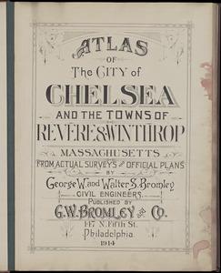
Atlas of the city of Chelsea and the towns of Revere & Winthrop, Massachusetts : from actual surveys and official plans
250.
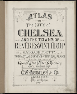
Atlas of the city of Chelsea and the towns of Revere and Winthrop : from actual surveys and official plans
251.
Atlas of the city of Chelsea and the towns of Revere & Winthrop, Massachusetts : from actual surveys and official plans
252.
Atlas of the city of Northampton and the town of Easthampton, Hampshire County, Massachusetts
253.
Atlas of the towns of Needham, Dover, Westwood, Millis and Medfield, Norfolk County, Massachusetts : from official plans and...
254.
Richards standard atlas of the city of Springfield and the town of Longmeadow, Massachusetts
255.
Atlas of the towns of Topsfield, Ipswich, Essex, Hamilton and Wenham, Essex County, Massachusetts : from official plans and...
256.
Atlas of the towns of Topsfield, Ipswich, Essex, Hamilton and Wenham, Essex County, Massachusetts
257.
Atlas of the towns of Needham, Dover, Westwood, Millis and Medfield, Norfolk county, Massachusetts
258.
Highway map of Plymouth County, Massachusetts : prepared for the Plymouth County atlas
259.
Rand, McNally & Co.'s indexed atlas of the world map of Bolivia, Ecuador, and Peru
260.
Peru and Bolivia
‹ Prev
Next ›
1
2
…
9
10
11
12
13
14
15
16
17
…
126
127