Toggle navigation
LMEC Home
Exhibitions
Georeferencing
Tools for Teachers
Collections
My Favorites
Sign Up / Log In
Search
Search the map portal
Map Collection
Map Collection
Map Sets
Search
Search
Search for
Search In
All Fields
Creator
Title
Subject
Place
Search All Digital Collections
Advanced Search
13672 Results
Filter your Search
Place
North and Central America
10,338
United States
8,469
Massachusetts
2,785
Suffolk (county)
1,677
Boston
1,633
Europe
1,413
Canada
950
New York
649
more
Place
»
Topic
Boston (Mass.)--Maps
747
City planning--Massachusetts--Boston--Maps
418
United States--History--Revolution, 1775-1783--Maps
329
United States--Maps
321
Real property--Massachusetts--Boston--Maps
254
Urban renewal--Massachusetts--Boston--Maps
254
Massachusetts--Maps
231
Insurance surveys
197
more
Topic
»
Date
Date range begin
–
Date range end
Current results range from
1482
to
2023
View distribution
Creator
United States. Hydrographic Office
597
Boston Redevelopment Authority
404
Des Barres, Joseph F. W. (Joseph Frederick Wallet), 1722-1824
247
Royal United Services Institute for Defence and Security Studies
160
Jefferys, Thomas, -1771
154
George, III, King of Great Britain, 1738-1820
152
George, IV, King of Great Britain, 1762-1830
151
O.H. Bailey & Co
148
more
Creator
»
Format
Maps/Atlases
13,491
Manuscripts
985
Prints
102
Books
49
Drawings/Illustrations
44
Photographs
15
Objects/Artifacts
13
Documents
7
more
Format
»
Georeferenced
Yes
979
No
12,693
Collection
Norman B. Leventhal Map & Education Center Collection
9,089
American Revolutionary War-Era Maps
3,305
Boston and New England Maps
2,911
Urban Maps
2,466
Maritime Charts and Atlases
1,169
William L. Clements Library Collection
910
Library of Congress Collection
618
Boston Redevelopment Authority Collection
475
more
Collection
»
Available to use
No known restrictions
10,239
Creative Commons license
1,677
Search Constraints
Sort by relevance
relevance
title
date (asc)
date (desc)
Number of results to display per page
20 per page
10
per page
20
per page
50
per page
100
per page
View results as:
grid view
map view
Search Results
13101.
View of Cheshire, Connecticut : 1882
13102.
View of Chester, Connecticut : 1881
13103.
View of Clinton, Connecticut : 1881
13104.
View of College Point, L.I : 1876
13105.
View of Collinsville, Conn : 1878
13106.
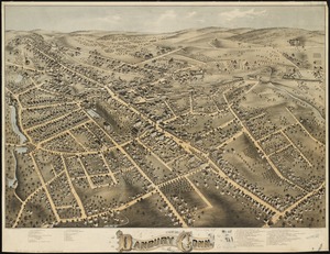
View of Danbury, Conn : 1875
13107.
View of Dedham, Mass. in 1876
13108.
View of Dorchester Neck from Enoch Brown's
13109.
View of Dorchester Neck, from the mess house on Fort Hill
13110.
View of Dorchester Neck, from the mess house on Fort Hill
13111.
View of East Boston, Mass : 1879
13112.
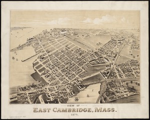
View of East Cambridge, Mass., 1879
13113.
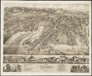
View of Essex, Centerbrook & Ivoryton, Conn : 1881
13114.
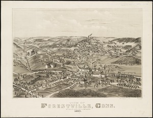
View of Forestville, Conn : 1880
13115.
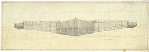
A view of Fort Harmer at 100 yards distance from projecting angle of a bastion
13116.
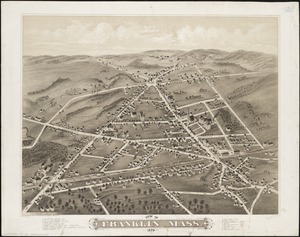
View of Franklin, Mass : 1879
13117.
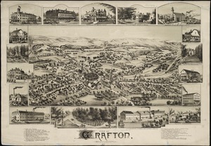
View of Grafton, Massachusetts : 1887
13118.
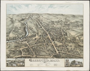
View of Greenfield, Mass
13119.
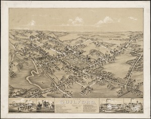
View of Guilford, Connecticut : 1881
13120.
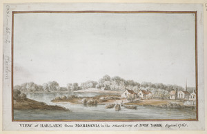
VIEW of HARLAEM from MORISANIA in the PROVINCE of NEW YORK Septem.r 1765
‹ Prev
Next ›
1
2
…
652
653
654
655
656
657
658
659
660
…
683
684