Toggle navigation
LMEC Home
Exhibitions
Georeferencing
Tools for Teachers
Collections
My Favorites
Sign Up / Log In
Search
Search the map portal
Map Collection
Map Collection
Map Sets
Search
Search
Search for
Search In
All Fields
Creator
Title
Subject
Place
Search All Digital Collections
Advanced Search
13673 Results
Filter your Search
Place
North and Central America
10,339
United States
8,470
Massachusetts
2,786
Suffolk (county)
1,677
Boston
1,633
Europe
1,413
Canada
950
New York
649
more
Place
»
Topic
Boston (Mass.)--Maps
747
City planning--Massachusetts--Boston--Maps
418
United States--History--Revolution, 1775-1783--Maps
329
United States--Maps
321
Real property--Massachusetts--Boston--Maps
254
Urban renewal--Massachusetts--Boston--Maps
254
Massachusetts--Maps
231
Insurance surveys
197
more
Topic
»
Date
Date range begin
–
Date range end
Current results range from
1482
to
2023
View distribution
Creator
United States. Hydrographic Office
597
Boston Redevelopment Authority
404
Des Barres, Joseph F. W. (Joseph Frederick Wallet), 1722-1824
247
Royal United Services Institute for Defence and Security Studies
160
Jefferys, Thomas, -1771
154
George, III, King of Great Britain, 1738-1820
152
George, IV, King of Great Britain, 1762-1830
151
O.H. Bailey & Co
148
more
Creator
»
Format
Maps/Atlases
13,492
Manuscripts
985
Prints
102
Books
49
Drawings/Illustrations
44
Photographs
15
Objects/Artifacts
13
Documents
7
more
Format
»
Georeferenced
Yes
979
No
12,694
Collection
Norman B. Leventhal Map & Education Center Collection
9,090
American Revolutionary War-Era Maps
3,305
Boston and New England Maps
2,912
Urban Maps
2,467
Maritime Charts and Atlases
1,169
William L. Clements Library Collection
910
Library of Congress Collection
618
Boston Redevelopment Authority Collection
475
more
Collection
»
Available to use
No known restrictions
10,240
Creative Commons license
1,677
Search Constraints
Sort by relevance
relevance
title
date (asc)
date (desc)
Number of results to display per page
20 per page
10
per page
20
per page
50
per page
100
per page
View results as:
grid view
map view
Search Results
13061.
Vertical sections to accompany the geological map of the Boulder Belt, East Coolgardie, G.F.
13062.
Vesconte de Maiollo conposuy hanc cartan in Janua anno dñy. 1587. die xx. Decenbris
13063.
Vestigie di Roma antica per gli annali della stessa città
13064.
Via RCA : a direct marine radio service to and from ships at sea
13065.
Viaggio ai tre laghi Maggiore, di Lugano e di Como al Monte Rosa, al Sempione ed al Sacro Monte di Varallo
13066.
Vicksburg and its defences : constructed and engraved to illustrate "The war with the South"
13067.
Victoria
13068.
Victoria
13069.
Victory map
13070.
Victory map 1919
13071.
The victory war map
13072.
Viennense territorium ob res bellicas inter Christianos et Turcas nuperrime editum
13073.
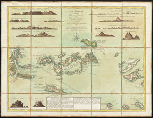
Les Vierges, levées par les Anglais, et par les Dannois : traduit de l'Anglais
13074.
Vieux Paris et ses monuments (XVIIe siècle) : avec le tracé de ses limites sous Philippe-Auguste, Charles VI, Louis XII et...
13075.
View from the blockhouse : Dorchester Neck
13076.
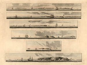
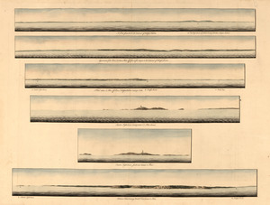
A view from the south eastward of Halifax Harbor : Appearance of the shore, (at three miles off,) four or five leagues to the...
13077.
A view from the south eastward of Halifax Harbor ; Appearance of the shore at three miles off four or five leagues to the...
13078.
A view from the south eastward of Halifax Harbor ; Appearance of the shore at three miles off four or five leagues to the...
13079.
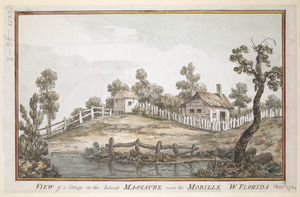
VIEW of a Cottage on the Island MASSACRE near the MOBILLE W. FLORIDA. Oct.r 1764
13080.
View of Amherst, Mass
‹ Prev
Next ›
1
2
…
650
651
652
653
654
655
656
657
658
…
683
684