Toggle navigation
LMEC Home
Exhibitions
Georeferencing
Tools for Teachers
Collections
My Favorites
Sign Up / Log In
Search
Search the map portal
Map Collection
Map Collection
Map Sets
Search
Search
Search for
Search In
All Fields
Creator
Title
Subject
Place
Search All Digital Collections
Advanced Search
722 Results
My Search
Start Over
Subject
aerial views
Remove constraint Subject: aerial views
Filter your Search
Place
North and Central America
651
United States
620
Suffolk (county)
65
Boston
63
Middlesex (county)
53
Worcester (county)
42
Europe
38
Norfolk (county)
33
more
Place
»
Topic
Boston (Mass.)--Aerial views
42
Franco-Prussian War, 1870-1871--Aerial views
7
Aerial views
6
France--History--1789-1900--Aerial views
6
Germany--History--1789-1900--Aerial views
6
United States--History--Revolution, 1775-1783--Maps
6
Boston (Mass.)--History--Revolution, 1775-1783--Aerial views--Early works to 1800
5
Boston (Mass.)--History--Siege, 1775-1776--Aerial views--Early works to 1800
5
more
Topic
»
Date
Date range begin
–
Date range end
Current results range from
1493
to
2020
View distribution
Creator
O.H. Bailey & Co
146
Norris, George E.
51
Burleigh, L. R., 1853-1923
47
Bailey, O. H. (Oakley Hoopes), 1843-1947
41
Poole, A. F.
22
Bailey, H. H. (Howard Heston), 1836-1878
20
Bachmann, John, fl. 1849-1885
8
Fowler, T. M. (Thaddeus Mortimer), 1842-1922
8
more
Creator
»
Format
Maps/Atlases
699
Prints
18
Manuscripts
12
Drawings/Illustrations
11
Georeferenced
Yes
5
No
717
Collection
Norman B. Leventhal Map Center Collection
694
Urban Maps
575
Boston and New England Maps
449
American Revolutionary War-Era Maps
30
Richard H. Brown Revolutionary War Map Collection at Mount Vernon
11
Boston Redevelopment Authority Collection
8
William L. Clements Library Collection
7
Library of Congress Collection
4
more
Collection
»
Available to use
No known restrictions
691
Creative Commons license
20
Search Constraints
Sort by relevance
relevance
title
date (asc)
date (desc)
Number of results to display per page
20 per page
10
per page
20
per page
50
per page
100
per page
View results as:
grid view
map view
Search Results
1.
Birds eye view of the Soudan
2.
Magnus' panoramic view map of India
3.
Balloon view Provincetown to Boston
4.
Birds-eye view of Boston and vicinity : showing the outlying towns and villages and railroad communications
5.
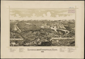
Rochdale and Greenville, Mass : 1887
6.
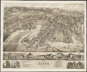
View of Essex, Centerbrook & Ivoryton, Conn : 1881
7.
Harris, Phenix and Lippitt, Rhode Island
8.
Balloon view--Boston Harbor
9.
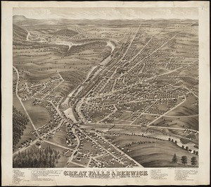
Bird's eye view of Great Falls, Strafford Co., New Hampshire & Berwick, York Co., Maine, 1877 : from position north west,...
10.
Cochituate, Mass. and North Natick, 1887
11.
Amesbury and Salisbury Mills, Mass : 1880
12.
Baldwinville, Mass
13.
Bird's eye view of the city of Olympia, East Olympia and Tumwater, Puget Sound, Washington Territory, 1879
14.
Bird's eye view of the town of Nantucket in the State of Massachusetts : looking southwest : 1881
15.
Sturbridge and Fiskdale, Massachusetts
16.
View of Saxonville, Mass
17.
Views of the Boston Harbor Islands
18.
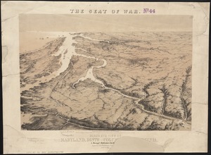
Bird's eye view of part of Maryland, Distr of Columbia and part of Virginia
19.
Balloon view, Cape Ann to Boston
20.
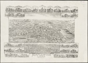
Maplewood and Linden, Massachusetts, 1897
‹ Prev
Next ›
1
2
3
4
5
…
36
37