Toggle navigation
LMEC Home
Exhibitions
Georeferencing
Tools for Teachers
Collections
My Favorites
Sign Up / Log In
Search
Search the map portal
Map Collection
Map Collection
Map Sets
Search
Search
Search for
Search In
All Fields
Creator
Title
Subject
Place
Search All Digital Collections
Advanced Search
722 Results
My Search
Start Over
Subject
aerial views
Remove constraint Subject: aerial views
Filter your Search
Place
North and Central America
654
United States
624
Massachusetts
295
Suffolk (county)
65
Boston
63
New Hampshire
55
Connecticut
53
Middlesex (county)
53
more
Place
»
Topic
Boston (Mass.)--Aerial views
42
Franco-Prussian War, 1870-1871--Aerial views
7
Aerial views
6
France--History--1789-1900--Aerial views
6
Germany--History--1789-1900--Aerial views
6
United States--History--Revolution, 1775-1783--Maps
6
Boston (Mass.)--History--Revolution, 1775-1783--Aerial views--Early works to 1800
5
Boston (Mass.)--History--Siege, 1775-1776--Aerial views--Early works to 1800
5
more
Topic
»
Date
Date range begin
–
Date range end
Current results range from
1493
to
2020
View distribution
Creator
O.H. Bailey & Co
146
Norris, George E.
51
Burleigh, L. R., 1853-1923
47
Bailey, O. H. (Oakley Hoopes), 1843-1947
41
Poole, A. F.
22
Bailey, H. H. (Howard Heston), 1836-1878
20
Bachmann, John, fl. 1849-1885
8
Fowler, T. M. (Thaddeus Mortimer), 1842-1922
8
more
Creator
»
Format
Maps/Atlases
699
Prints
18
Manuscripts
12
Drawings/Illustrations
11
Georeferenced
Yes
5
No
717
Collection
Norman B. Leventhal Map & Education Center Collection
694
Urban Maps
575
Boston and New England Maps
449
American Revolutionary War-Era Maps
30
Richard H. Brown Revolutionary War Map Collection at Mount Vernon
11
Boston Redevelopment Authority Collection
8
William L. Clements Library Collection
7
Library of Congress Collection
4
more
Collection
»
Available to use
No known restrictions
691
Creative Commons license
20
Search Constraints
Sort by relevance
relevance
title
date (asc)
date (desc)
Number of results to display per page
20 per page
10
per page
20
per page
50
per page
100
per page
View results as:
grid view
map view
Search Results
101.
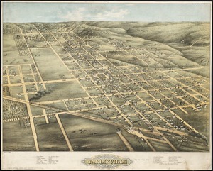
Bird's eye view of Carlinville, Macoupin County Ill : 1873
102.
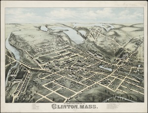
Bird's eye view of Clinton, Mass : 1876
103.
Bird's eye view of Collingwood, Ontario, Canada
104.
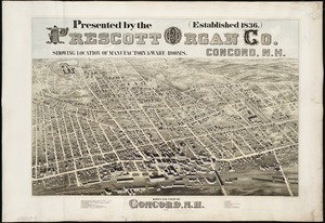
Bird's eye view of Concord, N.H : 1875
105.
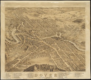
Bird's eye view of Dover, Strafford Co., New Hampshire : 1877, looking southwest
106.
A Bird's eye view of Dublin
107.
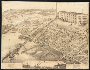
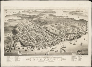
Bird's eye view of Eastport, Washington Co., Maine
108.
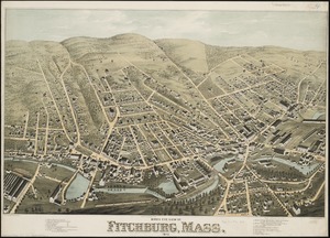
Bird's eye view of Fitchburg, Mass : 1875
109.
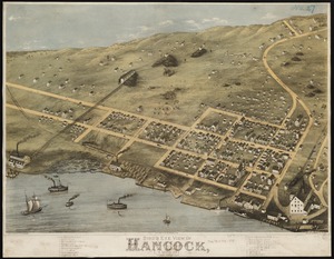
Bird's eye view of Hancock, L.S. Mich, 1873 : looking north west
110.
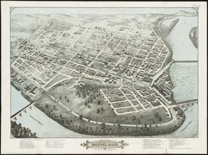
Bird's eye view of Holyoke, Mass : 1877
111.
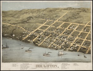
Bird's eye view of Houghton, L.S., Michigan, 1872 : looking south east
112.
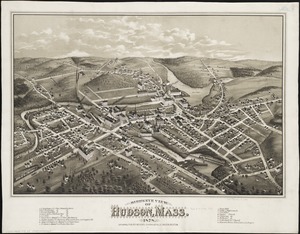
Bird's eye view of Hudson, Mass : 1878
113.
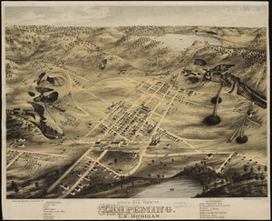
Bird's eye view of Ishpeming, L.S. Michigan : 1871
114.
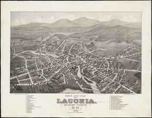
Bird's eye view of Laconia, Belknap County, N.H : 1883
115.
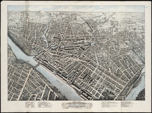
Birds eye view of Lowell, Mass : 1876
116.
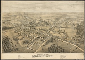
Bird's eye view of Morristown, Morris Co., New Jersey : 1876
117.
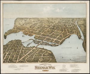
Bird's eye view of Neenah, Wis : 1879
118.
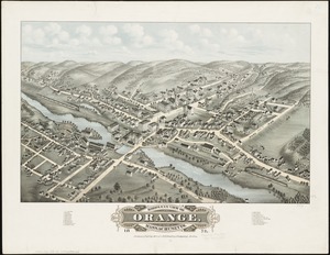
Bird's eye view of Orange, Massachusetts : 1878
119.
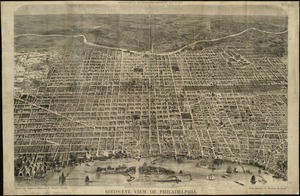
Bird's eye view of Philadelphia
120.
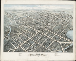
Bird's eye view of Pittsfield, Mass : 1876
‹ Prev
Next ›
1
2
3
4
5
6
7
8
9
10
…
36
37