Toggle navigation
LMEC Home
Exhibitions
Georeferencing
Tools for Teachers
Collections
My Favorites
Sign Up / Log In
Search
Search the map portal
Map Collection
Map Collection
Map Sets
Search
Search
Search for
Search In
All Fields
Creator
Title
Subject
Place
Search All Digital Collections
Advanced Search
722 Results
My Search
Start Over
Subject
aerial views
Remove constraint Subject: aerial views
Filter your Search
Place
North and Central America
654
United States
624
Massachusetts
295
Suffolk (county)
65
Boston
63
New Hampshire
55
Connecticut
53
Middlesex (county)
53
more
Place
»
Topic
Boston (Mass.)--Aerial views
42
Franco-Prussian War, 1870-1871--Aerial views
7
Aerial views
6
France--History--1789-1900--Aerial views
6
Germany--History--1789-1900--Aerial views
6
United States--History--Revolution, 1775-1783--Maps
6
Boston (Mass.)--History--Revolution, 1775-1783--Aerial views--Early works to 1800
5
Boston (Mass.)--History--Siege, 1775-1776--Aerial views--Early works to 1800
5
more
Topic
»
Date
Date range begin
–
Date range end
Current results range from
1493
to
2020
View distribution
Creator
O.H. Bailey & Co
146
Norris, George E.
51
Burleigh, L. R., 1853-1923
47
Bailey, O. H. (Oakley Hoopes), 1843-1947
41
Poole, A. F.
22
Bailey, H. H. (Howard Heston), 1836-1878
20
Bachmann, John, fl. 1849-1885
8
Fowler, T. M. (Thaddeus Mortimer), 1842-1922
8
more
Creator
»
Format
Maps/Atlases
699
Prints
18
Manuscripts
12
Drawings/Illustrations
11
Georeferenced
Yes
5
No
717
Collection
Norman B. Leventhal Map & Education Center Collection
694
Urban Maps
575
Boston and New England Maps
449
American Revolutionary War-Era Maps
30
Richard H. Brown Revolutionary War Map Collection at Mount Vernon
11
Boston Redevelopment Authority Collection
8
William L. Clements Library Collection
7
Library of Congress Collection
4
more
Collection
»
Available to use
No known restrictions
691
Creative Commons license
20
Search Constraints
Sort by relevance
relevance
title
date (asc)
date (desc)
Number of results to display per page
20 per page
10
per page
20
per page
50
per page
100
per page
View results as:
grid view
map view
Search Results
381.
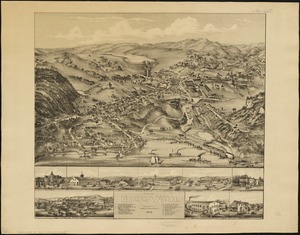
View of Higganum, Connecticut : 1881
382.
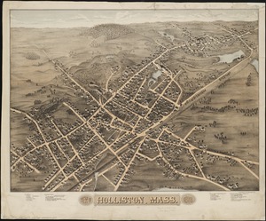
View of Holliston, Mass : 1878
383.
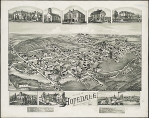
View of Hopedale, Massachusetts : 1888
384.
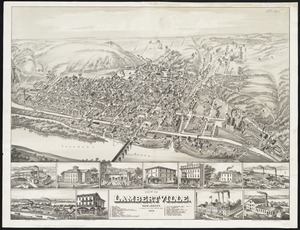
View of Lambertville, New Jersey
385.
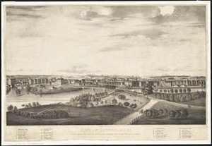
View of Lowell, Mass : taken from the house of Elisha Fuller Esq. in Dracut
386.
View of Lynn, Mass. in 1849 : from High Rock
387.
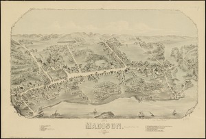
View of Madison, Conn : 1881
388.
View of Marlborough, Mass : 1879
389.
View of Medway, Massachusetts : 1887
390.
View of Methuen, Massachusetts : 1882
391.
View of Milford, Conn : 1882
392.
View of Milford, Mass : 1876
393.
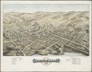
View of Natick, Mass : 1877, population about 8000
394.
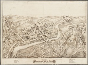
View of Naugatuck, Conn : 1877
395.
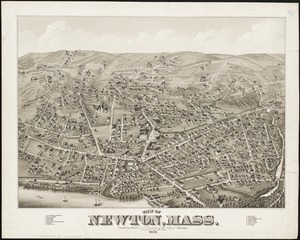
View of Newton, Mass : comprising Wards 1 & 7 & environs of the city of Newton
396.
View of North Manchester, Connecticut : 1880
397.
View of Northborough, Massachusetts : 1887
398.
View of Oneida, N.Y : 1874
399.
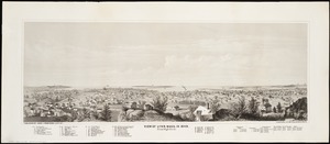
View of Palmer, Mass
400.
View of Peabody, Mass : 1877
‹ Prev
Next ›
1
2
…
16
17
18
19
20
21
22
23
24
…
36
37