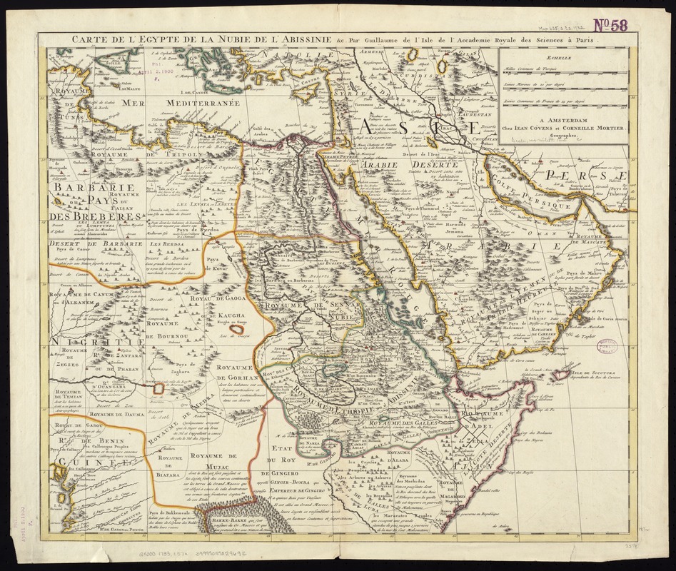
Carte de l'Egypte, de la Nubie, de l'Abissinie &c
Item Information
- Title:
- Carte de l'Egypte, de la Nubie, de l'Abissinie &c
- Creator:
- L'Isle, Guillaume de, 1675-1726
- Name on Item:
-
par Guillaume de l'Isle.
- Date:
-
[1733]
- Format:
-
Maps/Atlases
- Location:
-
Boston Public Library
Norman B. Leventhal Map & Education Center - Collection (local):
-
Norman B. Leventhal Map & Education Center Collection
- Subjects:
-
Egypt--Maps--Early works to 1800
Nubia--Maps--Early works to 1800
Ethiopia--Maps--Early works to 1800
Arabian Peninsula--Maps--Early works to 1800
- Places:
-
Egypt
Arabian Peninsula (area)
Nubia (area)
Ethiopia
- Extent:
- 1 map : hand col. ; 47 x 57 cm.
- Terms of Use:
-
No known copyright restrictions.
No known restrictions on use.
- Publisher:
-
A Amsterdam :
Chez Jean Cóvens et Corneille Mortier
- Scale:
-
Scale [ca. 1:9,300,000]
- Language:
-
French
- Notes:
-
Relief shown pictorially.
Appears in the author's Atlas Nouveau. Amsterdam: J. Covens & C. Mortier, 1733.
- Notes (date):
-
This date is inferred.
- Identifier:
-
06_01_007110
- Call #:
-
G8300 1733 .L57x
- Barcode:
-
39999059029692


![Sexta Asie tabula continet Arabiam, Felice atq[ue] Carmania cu adiacentibus insulis](https://bpldcassets.blob.core.windows.net/derivatives/images/commonwealth:7h14b122w/image_thumbnail_300.jpg)