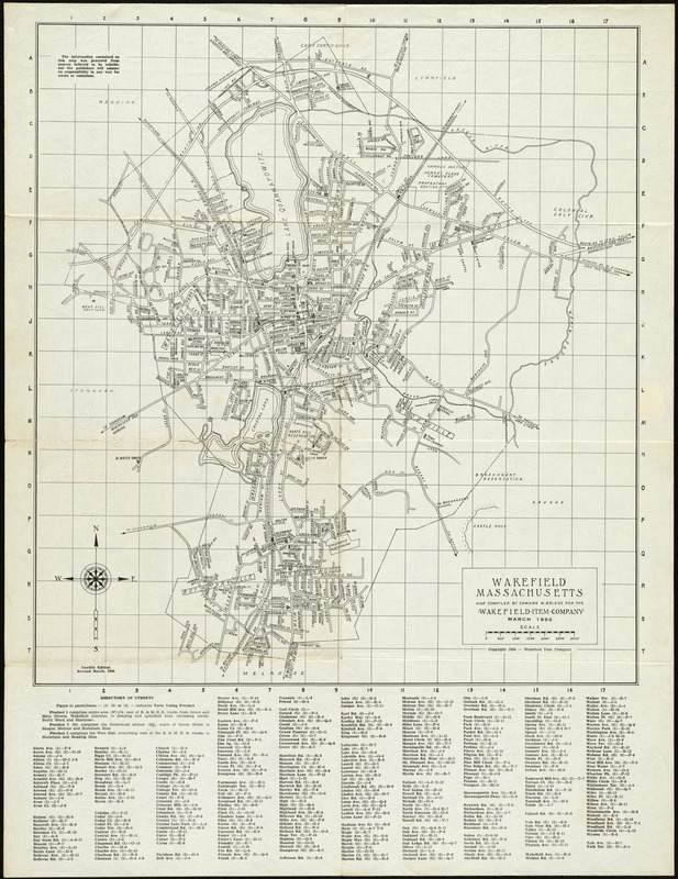
Wakefield, Massachusetts
Item Information
- Title:
- Wakefield, Massachusetts
- Creator:
- Bridge, Edward Melville, 1890-
- Sponsor:
- Wakefield Item Company
- Name on Item:
-
compiled by Edward M. Bridge for the Wakefield Item Company
- Date:
-
1950
- Format:
-
Maps/Atlases
- Location:
- Lucius Beebe Memorial Library
- Collection (local):
-
Lucius Beebe Memorial Library Historic Maps
- Places:
-
Middlesex (county)Wakefield
- Extent:
- 1 map : b&w ; 66 x 51 cm.
- Terms of Use:
-
No known copyright restrictions.
No known restrictions on use.
- Publisher:
-
Wakefield :
Wakefield Item Co.
- Edition:
- 12th ed., rev. March, 1950
- Scale:
-
Scale [ca. 1:13,300]
- Language:
-
English
- Notes:
-
Map depicts entire town of Wakefield in 1950, showing streets, major public buildings, schools, churches, cemeteries, railroad lines and stations, and water towers. Also depicted are names of sections of town. At bottom of map is a street and precinct directory.
- Call #:
-
Local History Map Case Wakefield 1950
- Barcode:
-
31392003576695


