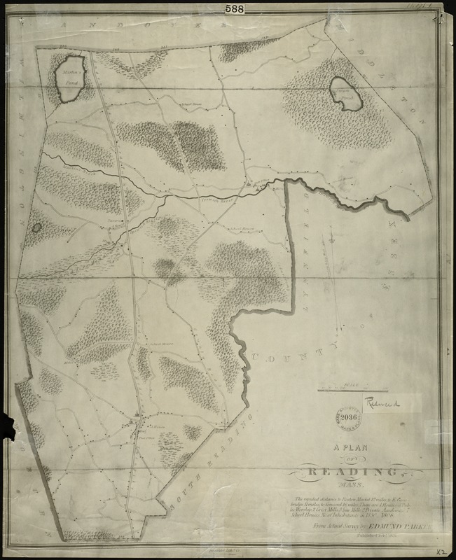
Plan of Reading, Mass. : showing roads, bodies of water, woodlands, homes, churches, schools, post offices, and taverns
Item Information
- Title:
- Plan of Reading, Mass. : showing roads, bodies of water, woodlands, homes, churches, schools, post offices, and taverns
- Creator:
- Parker, Edmund
- Lithographer:
- Senefelder Lith. Co.
- Name on Item:
-
From actual survey by Edmund Parker
- Date:
-
1831
- Format:
-
Maps/Atlases
- Location:
- Lucius Beebe Memorial Library
- Collection (local):
-
Lucius Beebe Memorial Library Historic Maps
- Places:
-
Middlesex (county)Reading
Middlesex (county)North Reading
- Extent:
- 1 map : b&w ; 55 x 45 cm.
- Terms of Use:
-
No known copyright restrictions.
No known restrictions on use.
- Publisher:
-
Boston :
Senefelder Lithographic Co.
- Scale:
-
Scale [ca. 1:30,000]
- Language:
-
English
- Notes:
-
Map depicts the town of Reading, including the area now covering North Reading, showing roads, bodies of water, woodlands, homes, churches, schools, post offices, and taverns.
"The reputed distance to Boston Market 12 miles, to E. Cambridge 11 miles, to Concord 16 miles. There are 4 Houses of Public Worship, 2 Grist Mills, 3 Saw Mills, 2 Private Academies, 7 School Houses. No. of inhabitants in 1830 - 1806. From actual survey by Edmund Parker. Published Feb'y 1831."-- Text from map.
- Call #:
-
Local History Map Case Reading 1831-2
- Barcode:
-
31392003576489


