A topographical map of the Etowah property, Cass County, Georgia
Item Information
- Title:
- A topographical map of the Etowah property, Cass County, Georgia
- Description:
-
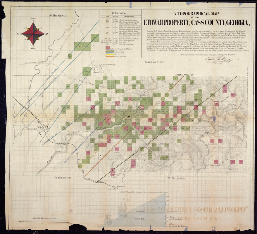
America Transformed: Georgia's gold rush ended by the early 1840s, but the discovery of other mineral resources, including iron, furthered the extensive exploitation of the landscape. During the first half of the 19th century, iron furnaces, which relied on charcoal, tended to be small rural operations located near iron deposits. One example is the Etowah Manufacturing and Mining Company located in northwestern Georgia. The accompanying topographic map shows that the small village encompassed the furnace, rolling mill, and workers' housing and stores, while the company owned at least 10,000 acres of surrounding forest. This landscape was altered by cutting down massive amounts of timber to produce charcoal.
- Cartographer:
- LeHardy, Eugene, -1874
- Name on Item:
-
made and drawn by the undersigned Civil and Topographical Engineer Eugene Le Hardy.
- Date:
-
1856
- Format:
-
Maps/Atlases
- Location:
- National Archives and Records Administration
- Collection (local):
-
National Archives and Records Administration Collection
- Subjects:
-
Bartow County (Ga.)--Maps
Mines and mineral resources--Georgia--Maps
Etowah Manufacturing and Mining Company
- Places:
-
Bartow (county)
- Extent:
- 1 map : color
- Terms of Use:
-
No known copyright restrictions.
No known restrictions on use.
- Publisher:
-
Etowah :
[Publisher not identified]
- Language:
-
English
- Notes:
-
Digitized from a positive film of the original held by the National Archives and Records Administration.
Relief shown by hachures.
Indicates property of the Etowah Manufacturing and Mining Company, individual property of M.A. Cooper, copper, iron ore, gold and elastic sandstone.
Includes references identifying facilities and mines.
Includes vertical profile Fall of the Etowah River from the lot 593 to the limit below the flour mill.
- Notes (exhibitions):
-
Exhibited: "America transformed. Part 1: the United States expands westward," organized by the Norman B. Leventhal Map & Education Center at the Boston Public Library, 2019.
- Identifier:
-
06_01016151
