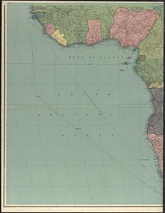
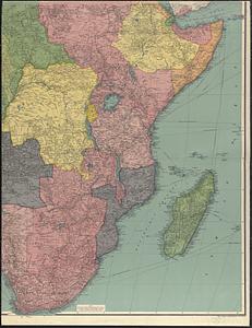
Philips' new library map of Africa


Item Information
- Title:
- Philips' new library map of Africa
- Cartographer:
- George Philip & Son
- Publisher:
- London Geographical Institute
- Name on Item:
-
George Philip & Son Ltd.
- Date:
-
[1921]
- Format:
-
Maps/Atlases
- Location:
-
Boston Public Library
Norman B. Leventhal Map & Education Center - Collection (local):
-
Norman B. Leventhal Map & Education Center Collection
- Subjects:
-
Africa--Maps
- Places:
-
Africa
Africa
- Extent:
- 1 map on 3 sheets : color ; 158 x 180 cm, sheets 120 x 93 cm and 59 x 175 cm
- Terms of Use:
-
No known copyright restrictions.
No known restrictions on use.
- Publisher:
-
[London] :
London Geographical Institute
- Scale:
-
Scale 1:4,752,000. 75 miles - 1 inch
- Language:
-
English
- Notes:
-
Relief shown by hachures and spot heights.
Shows wireless stations, railways, steamer routes, submarine cables, coaling stations, roads, air mail routes, oiling stations, and surface features.
- Notes (date):
-
This date is inferred.
- Identifier:
-
06_01_015372A
06_01_015372B
06_01_015372C
- Call #:
-
G8200 1921 .G46
- Barcode:
-
39999085935979


