Carta general del Archipiélago Filipino
Item Information
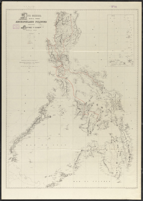
- Title:
- Carta general del Archipiélago Filipino
- Contributor:
- Greely, A. W. (Adolphus Washington), 1844-1935
- Contributor:
- Chofré and Company
- Contributor:
- United States. Army. Signal Corps
- Name on Item:
-
Chofré y Comp. ; reproduced under the direction of Brigadier General A.W. Greely, Chief Signal Officer, U.S. Army
- Date:
-
1899
- Format:
-
Maps/Atlases
- Location:
-
Boston Public Library
Norman B. Leventhal Map & Education Center - Collection (local):
-
Norman B. Leventhal Map & Education Center Collection
- Subjects:
-
Telegraph lines--Philippines--Maps
Philippines--Maps
- Places:
-
Philippines
- Extent:
- 1 map : color ; 110 x 81 cm
- Terms of Use:
-
No known copyright restrictions.
No known restrictions on use.
- Publisher:
-
[Washington, D.C.?] :
U.S. Army
- Scale:
-
Scale approximately 1:1,400,000
- Language:
-
Spanish
English
- Notes:
-
Relief shown by hachures.
Shows telegraph lines and district and province boundaries.
Inset: [Batanes and Babuyan Islands].
"Chofré y Compa. Manila 1897."
"For use of the Signal Corps, U.S.A. 1899."
In Spanish and English.
- Identifier:
-
06_01_015294
- Call #:
-
G8060 1897 .C37 1899
- Barcode:
-
39999085935383


