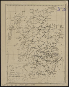
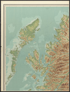
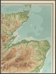
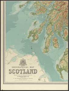
Orographical map of Scotland

Item Information
- Title:
- Orographical map of Scotland
- Cartographer:
- John Bartholomew & Co.
- Publisher:
- Edinburgh Geographical Institute
- Name on Item:
-
reduced from the Ordnance Survey by J.G. Bartholomew, LL.D. cartographer to the king at the Edinburgh Geographical Institute
- Date:
-
[1914]
- Format:
-
Maps/Atlases
- Location:
-
Boston Public Library
Norman B. Leventhal Map & Education Center - Collection (local):
-
Norman B. Leventhal Map & Education Center Collection
- Subjects:
-
Scotland--Maps
Topographic maps
- Places:
-
Scotland
- Extent:
- 1 map on 4 sheets : color ; 187 x 142 cm, on sheets 102 x 77 cm
- Terms of Use:
-
No known copyright restrictions.
No known restrictions on use.
- Publisher:
-
Edinburgh :
John Bartholomew & Co.
- Scale:
-
Scale 1:253,440. 4 miles to an inch
- Language:
-
English
- Notes:
-
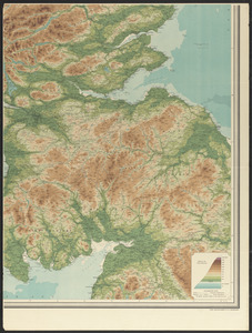
Relief shown by gradient tints and spot heights. Depths shown by bathymetric tints.
Shows roads, railways canals, footpaths and county boundaries.
In lower left: A 14.
- Notes (date):
-
This date is inferred.
- Identifier:
-
06_01_015050A
06_01_015050B
06_01_015050C
06_01_015050D
- Call #:
-
G5771.C2 1914 .J64
- Barcode:
-
39999085930160