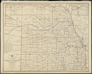
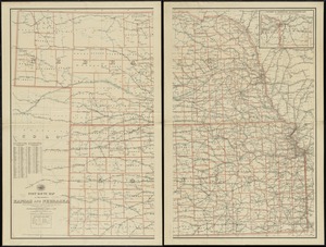
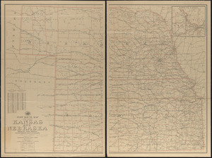
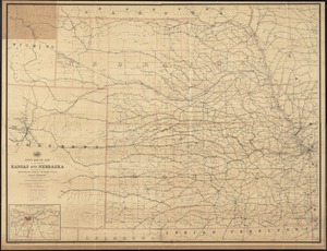
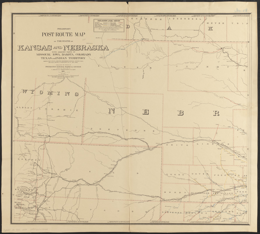
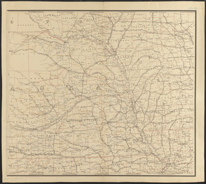
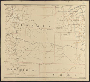
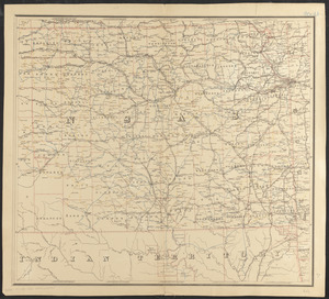
Preliminary post route map of the states of Kansas and Nebraska with adjacent parts of Missouri, Iowa, Dakota, Colorado, Texas, and Indian Territory, showing post offices, with the intermediate distances between them and mail routes in operation on 1st Aug. 1883

Item Information
- Title:
- Preliminary post route map of the states of Kansas and Nebraska with adjacent parts of Missouri, Iowa, Dakota, Colorado, Texas, and Indian Territory, showing post offices, with the intermediate distances between them and mail routes in operation on 1st Aug. 1883
- Publisher:
- United States. Post Office Department
- Contributor:
- Roeser, C. (Charles)
- Cartographer:
- Dinsmore, A. F. (Cartographer)
- Name on Item:
-
published by order of Postmaster General Walter Q. Gresham under the direction of C. Roeser, Jr., Topographer, P.O. Dept. ; drawn by A. F. Dinsmore
- Date:
-
1883
- Format:
-
Maps/Atlases
- Location:
-
Boston Public Library
Norman B. Leventhal Map & Education Center - Collection (local):
-
Norman B. Leventhal Map & Education Center Collection
- Subjects:
-
Postal service--Kansas--Maps
Postal service--Nebraska--Maps
Kansas--Maps
Nebraska--Maps
- Places:
-
Kansas
Nebraska
- Extent:
- 1 map on 4 sheets : col. ; 135 x 154 cm., on sheets 76 x 85 cm.
- Terms of Use:
-
No known copyright restrictions.
No known restrictions on use.
- Publisher:
-
[Washington, D.C.] :
Post Office Dept.
- Scale:
-
Scale [ca. 1:633,600]. 10 miles to the in.
- Language:
-
English
- Notes:
-
Prime meridian: Washington D. C.
"The service on this diagram brought up to date of Aug. 1 1883."
- Identifier:
-
06_01_008922A
06_01_008922B
06_01_008922C
06_01_008922D
- Call #:
-
G4201.P8 1883 .U55x
- Barcode:
-
39999065658864