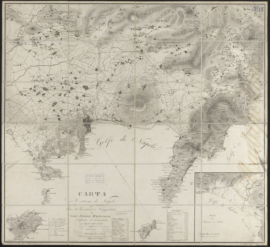
Carta de' contorni di Napoli
Item Information
- Title:
- Carta de' contorni di Napoli
- Cartographer:
- Westphal, Giovanni Enrico
- Publisher:
- Detken & Rocholl
- Name on Item:
-
per uso de'forestieri e viaggiatori di Giov. Enrico Westpahl rettificata ed accresciuta in Napoli a tutto il 1868
- Date:
-
1868
- Format:
-
Maps/Atlases
- Location:
-
Boston Public Library
Norman B. Leventhal Map & Education Center - Collection (local):
-
Norman B. Leventhal Map & Education Center Collection
- Subjects:
-
Naples (Italy)--Maps
- Places:
-
ItalyCampanian (region)Napoli (province)Naples
- Extent:
- 1 map ; 72 x 79 cm
- Terms of Use:
-
No known copyright restrictions.
No known restrictions on use.
- Publisher:
-
[Naples] :
presso Detken e Rocholl
- Scale:
-
Scale 1:90,000
- Language:
-
Italian
- Notes:
-
Relief shown by hachures.
Oriented with north to the upper left.
Inset: Strada da Salerno a Pesto.
Includes list of altitudes and list of populations.
- Identifier:
-
06_01_015106
- Call #:
-
G6714.N2 1868 .W47
- Barcode:
-
39999085931473