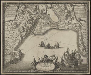
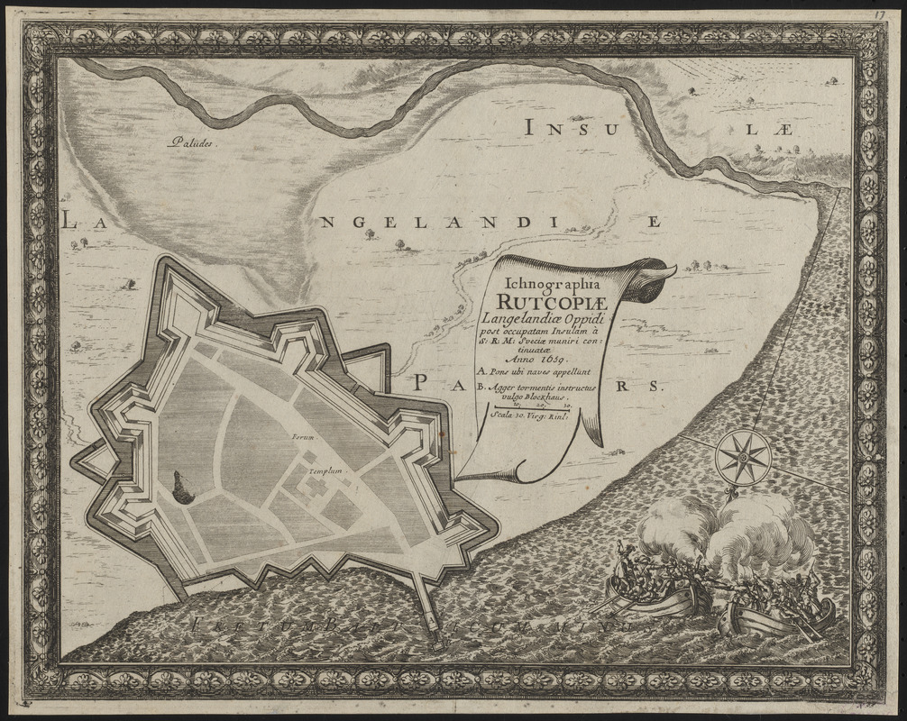
Ichnographia Rutcopiae Langelandiae oppidi post occupatam insulam à S.R.M. Sveciae muniri continuatae anno 1659
Item Information
- Title:
- Ichnographia Rutcopiae Langelandiae oppidi post occupatam insulam à S.R.M. Sveciae muniri continuatae anno 1659
- Publisher:
- Riegel, Christoph
- Contributor:
- Pufendorf, Samuel, Freiherr von, 1632-1694
- Cartographer:
- Dahlbergh, Erik Jönsson, greve, 1625-1703
- Date:
-
[1696]
- Format:
-
Maps/Atlases
- Location:
-
Boston Public Library
Norman B. Leventhal Map & Education Center - Collection (local):
-
Norman B. Leventhal Map & Education Center Collection
- Subjects:
-
Swedish-Polish War, 1655-1660--Maps--Early works to 1800
Swedish-Dutch War, 1658-1659--Maps--Early works to 1800
Rudkøbing (Denmark)--Maps--Early works to 1800
- Places:
-
DenmarkSyddanmark (region)Rudkøbing
- Extent:
- 1 map ; 22 x 29 cm
- Terms of Use:
-
No known copyright restrictions.
No known restrictions on use.
- Publisher:
-
[Nuremberg] :
[Sumptibus Christophori Riegelij]
- Scale:
-
Scale approximately 1:5,135
- Language:
-
Latin
- Notes:
-
From Samuel von Pufendorf's De rebus a Carolo Gustavo Sueciae rege gestis commentariorum libri septem. Norimbergae : Sumptibus Christophori Riegelij, 1696. Many plates from this work are attributed to Erik Jönsson Dahlbergh.
Relief shown by hachures.
Bar scale in "Virg. Rinl."
Oriented with north to the lower left.
Includes references and illustration of a naval battle.
"N. 95" --Lower right margin.
Conservation of this piece was funded by Anna Kuznetsova-Schafer and Ronald Schafer.
- Notes (date):
-
This date is inferred.
- Identifier:
-
06_01_016415
- Call #:
-
G2070 .P84 1696
- Barcode:
-
30000006603529